Weir Canyon Trail
Trailhead: Weir Canyon Gate 8 entrance
Difficulty Level: Moderate
Permit Required: Not for Hiking (Adventure Pass for parking)
Trail Summary
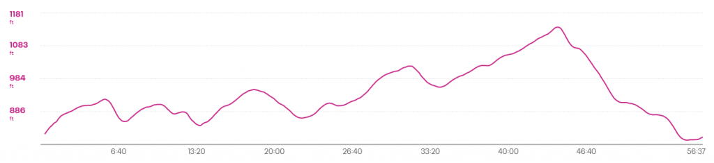
The weir canyon trail is a 3.6 mile loop trail in Yorba Linda (Anaheim Hills). The signs classify it as Difficult, but I would put it more in the moderate category. This can quickly change though if done in the summer as there is little to no shelter on the trail. There is pretty much continuous elevation gain/ loss throughout the hike as evidenced by the graph but overall its not excessively steep or long (except maybe for the end of the trail). I could see where it might be easy to get a few hills in though, become dehydrated in the summer heat and then be very hard to exit.
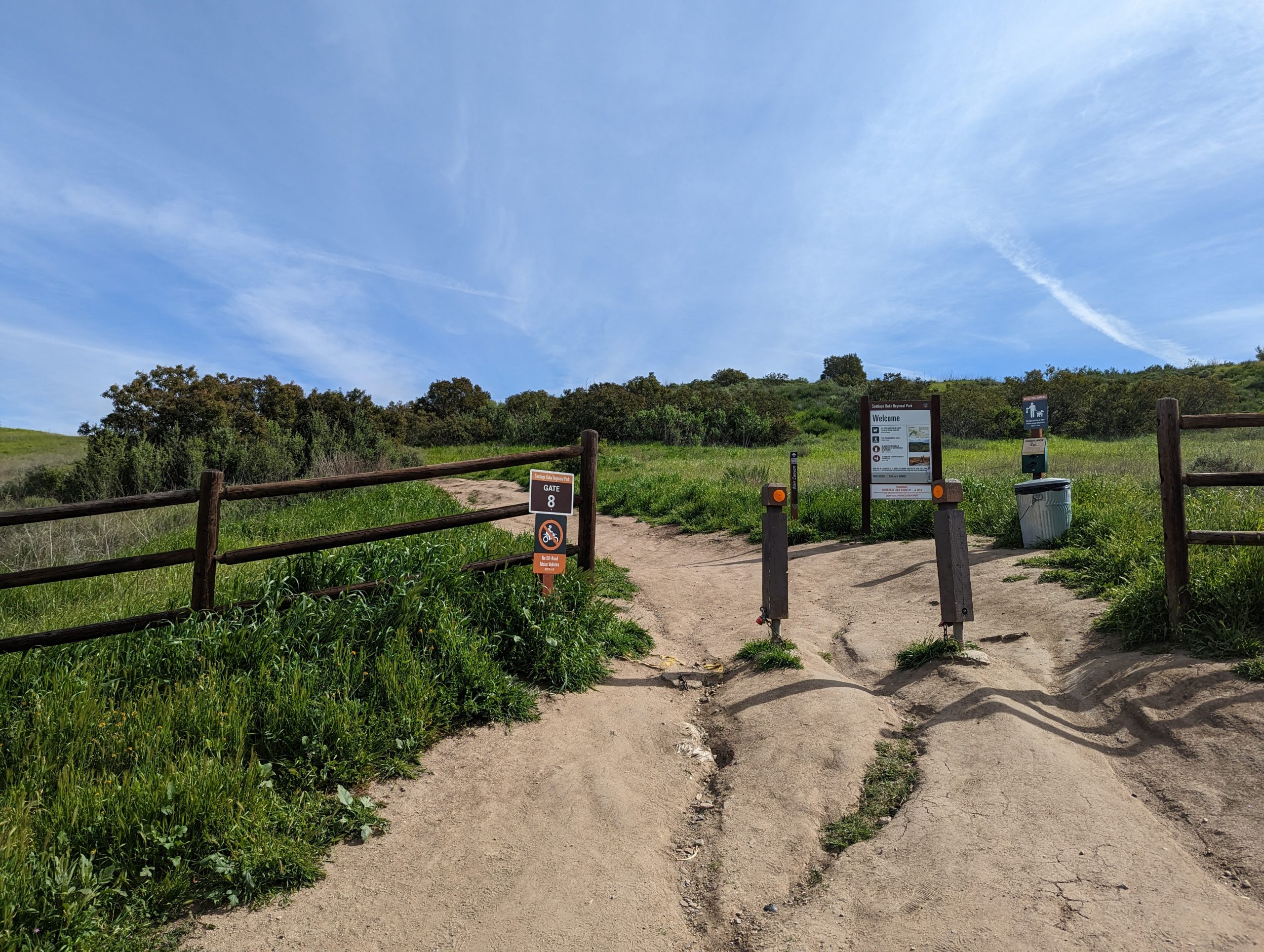
It is easily accessed from the Gate 8 entrance which is located on South Hidden Canyon Road. you can use this address as a GPS destination 1195 S Hidden Canyon Rd, Anaheim, CA 92807
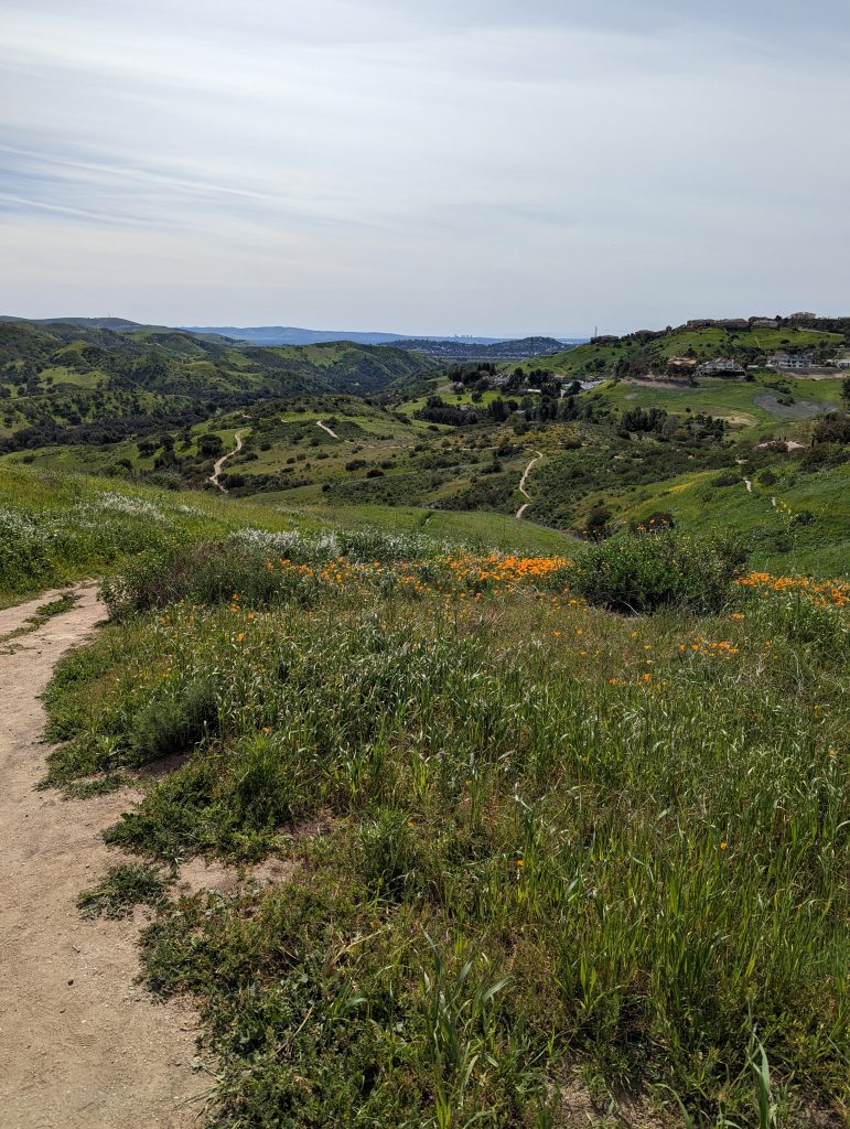
Be sure to notice the parking signs as there is only parking on one side of the street. This is a very popular trail, especially during the late winter/ early spring due to the poppy blooms.
Trail Report
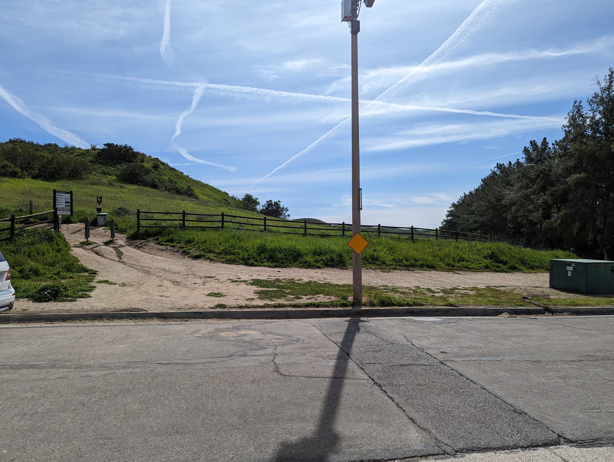
After finding some parking you will approach the trailhead. If you look closely at the image above you may see a path leading to the right which will lead down to the Anaheim hills trail. Our trail though, is to the left where the signs are.
The trail is well marked and seemingly well maintained as long as you stay on the “new” trail, which we’ll discuss later. Dogs are welcome on the trail and there are poop bags provided so be sure to take advantage of that if you bring your four legged friends.
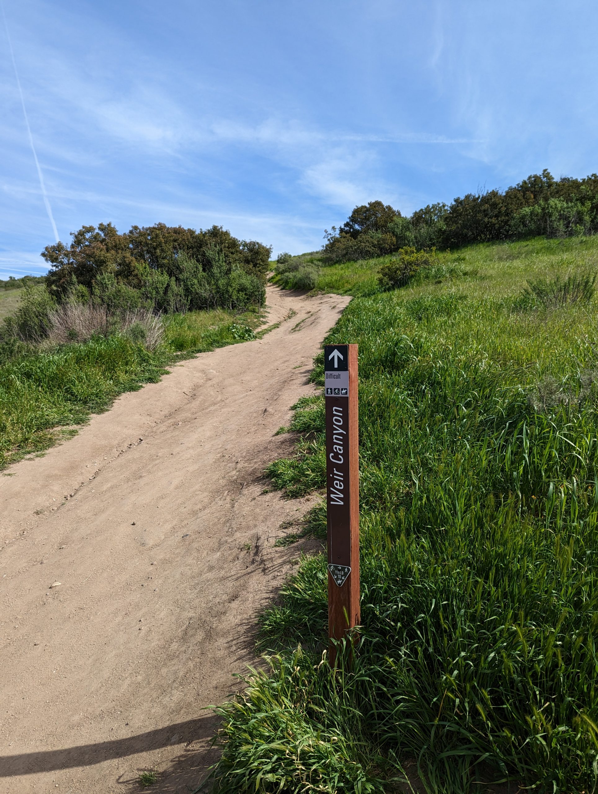
The trail is well maintained and each potential intersection has clear hard to miss signs. There can be a small bit of confusion though if you (like me) didn’t pay attention to the map at the trailhead. Within a couple of hundred feet of the beginning of the trail from Gate 8 there is a Trail sign on the left and a trail sign on the right, both indicating Weir Canyon trail. This is the start of the “lollipop”. For this review we stayed to the right (south) side of the fork.
You can see already from the first two pictures that the trail has a steady climb to it. This will be a pretty much continuous up and down for the length of the experience.

After about 3/4 of a mile of hiking comes the first really significant elevation gain. If you have your head up looking at the scenery you’ll notice the fence line switchbacking up the hill. This is the route that the trail takes. After you crest around the side of the hill you begin a relatively significant downhill portion.
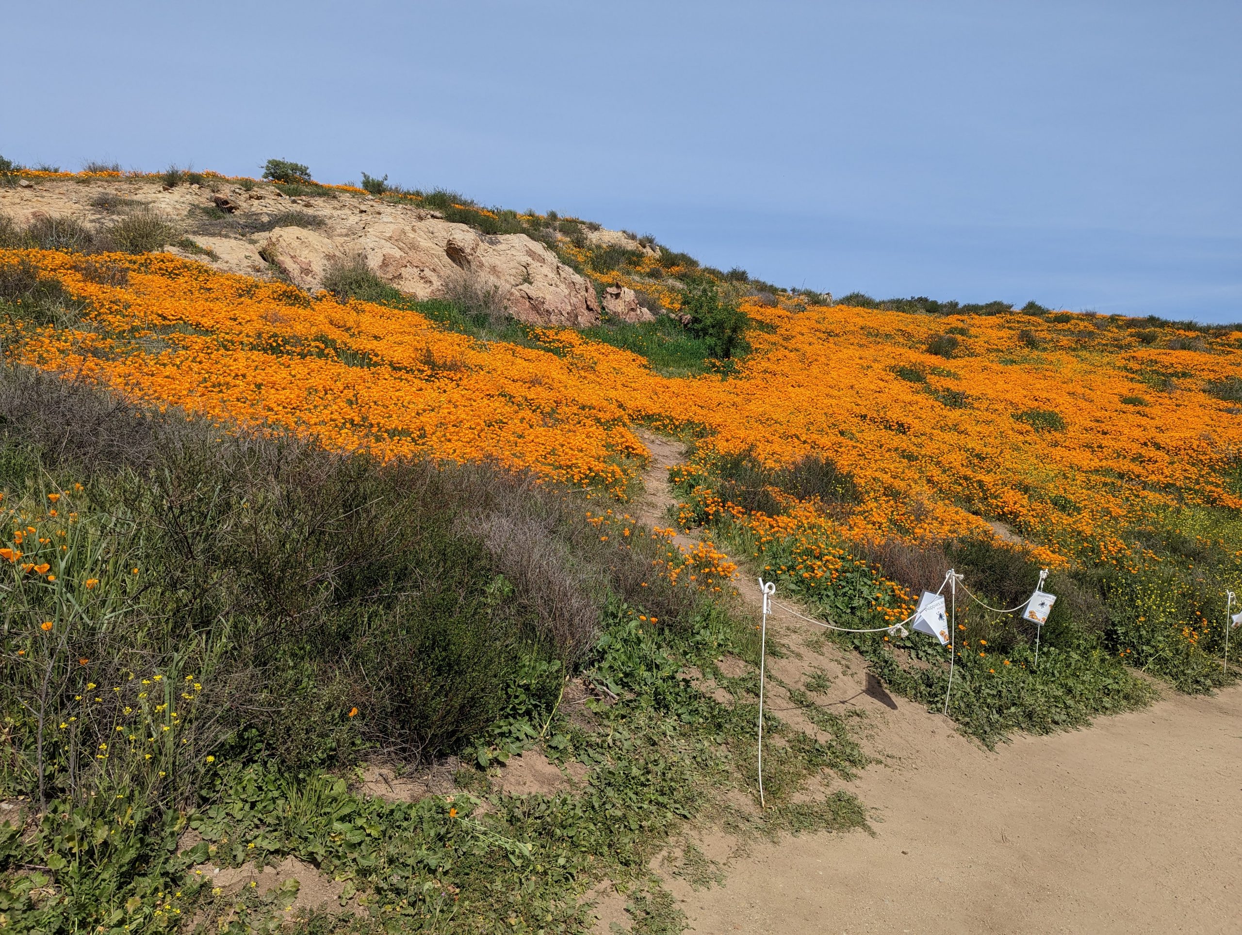

If you time it right in the early spring/ late winter, at about just over a mile into the trail is where the flowers really start to pop (pun intended). You’ll encounter an entire hillside of poppys as well as many other flowers of varying size and color (sorry, not a botanist).
There are a couple of options to shorten the total length of the hike. you can take the Deer Weed cutoff that will shave approximately a mile off the total distance of the trail. Unfortunately I didn’t get a photo of the sign at the East side of the loop, but there is one as it comes out at the West side.
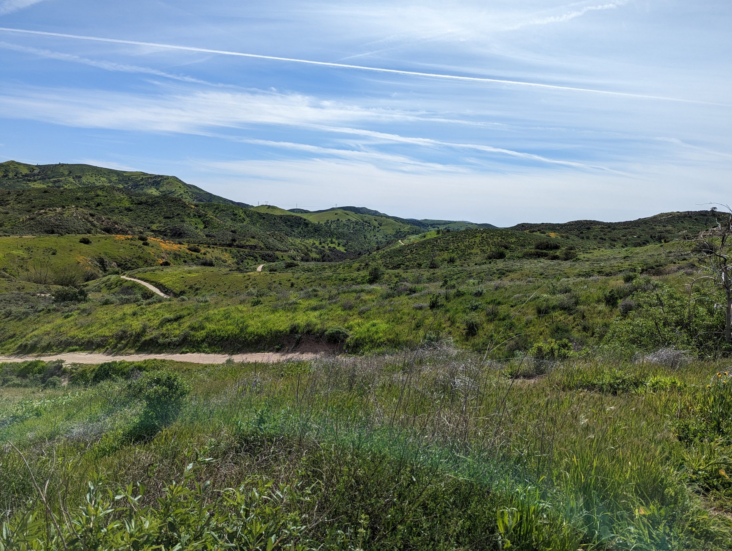
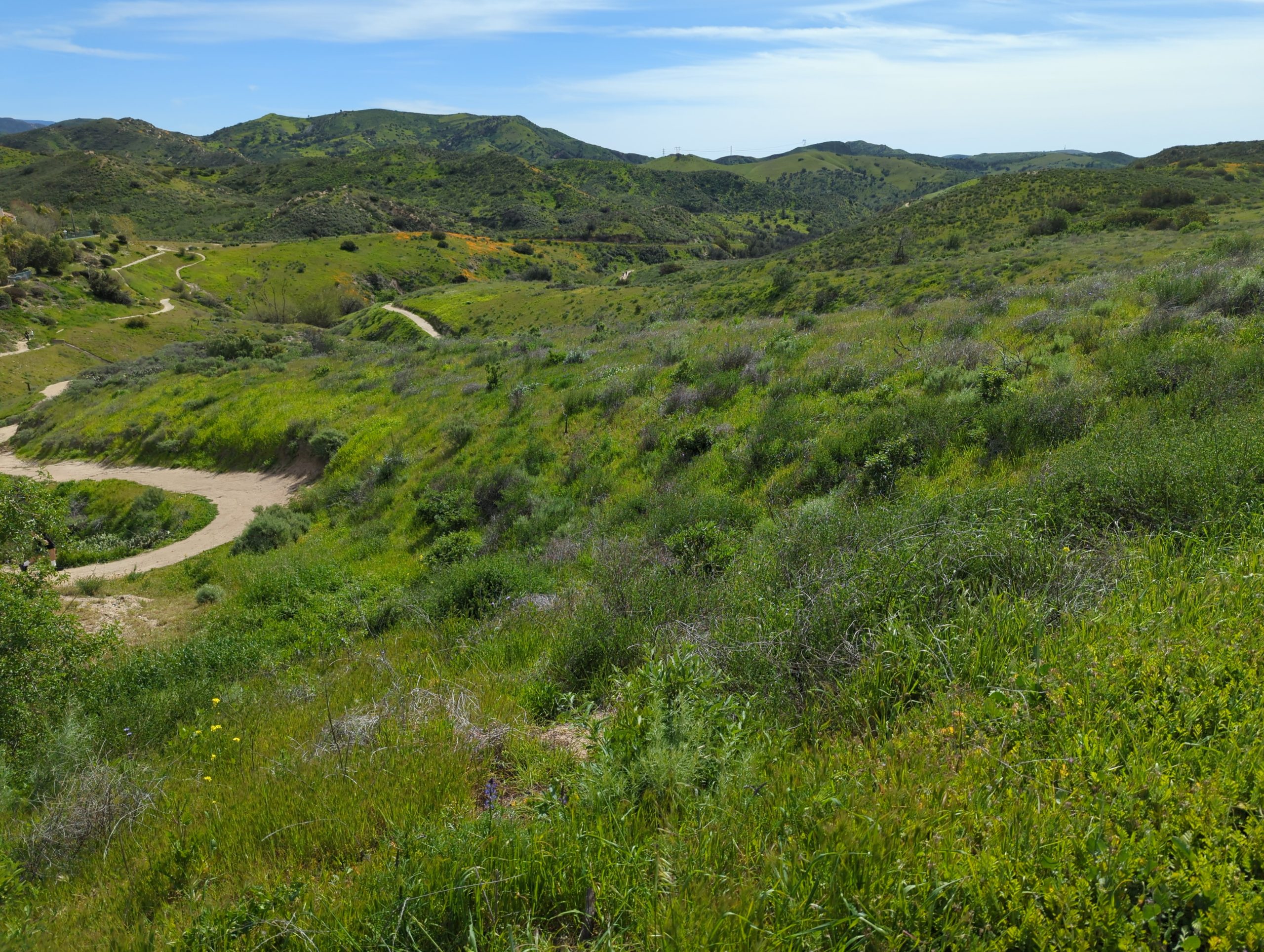
As you continue to head back to the east side of the park towards the houses, don’t forget to periodically turn around and see the views from where you came from. As you can see from above the hills in late February can be stunningly beautiful. Almost never know that just across the hill is the dreaded 91 freeway.

After rounding the North end loop of the trail you’ll begin to make your way back south to the starting point. The trail will roughly follow the hill crest and eventually encounter the upper connection point for the Deer Weed cutoff that was mentioned earlier
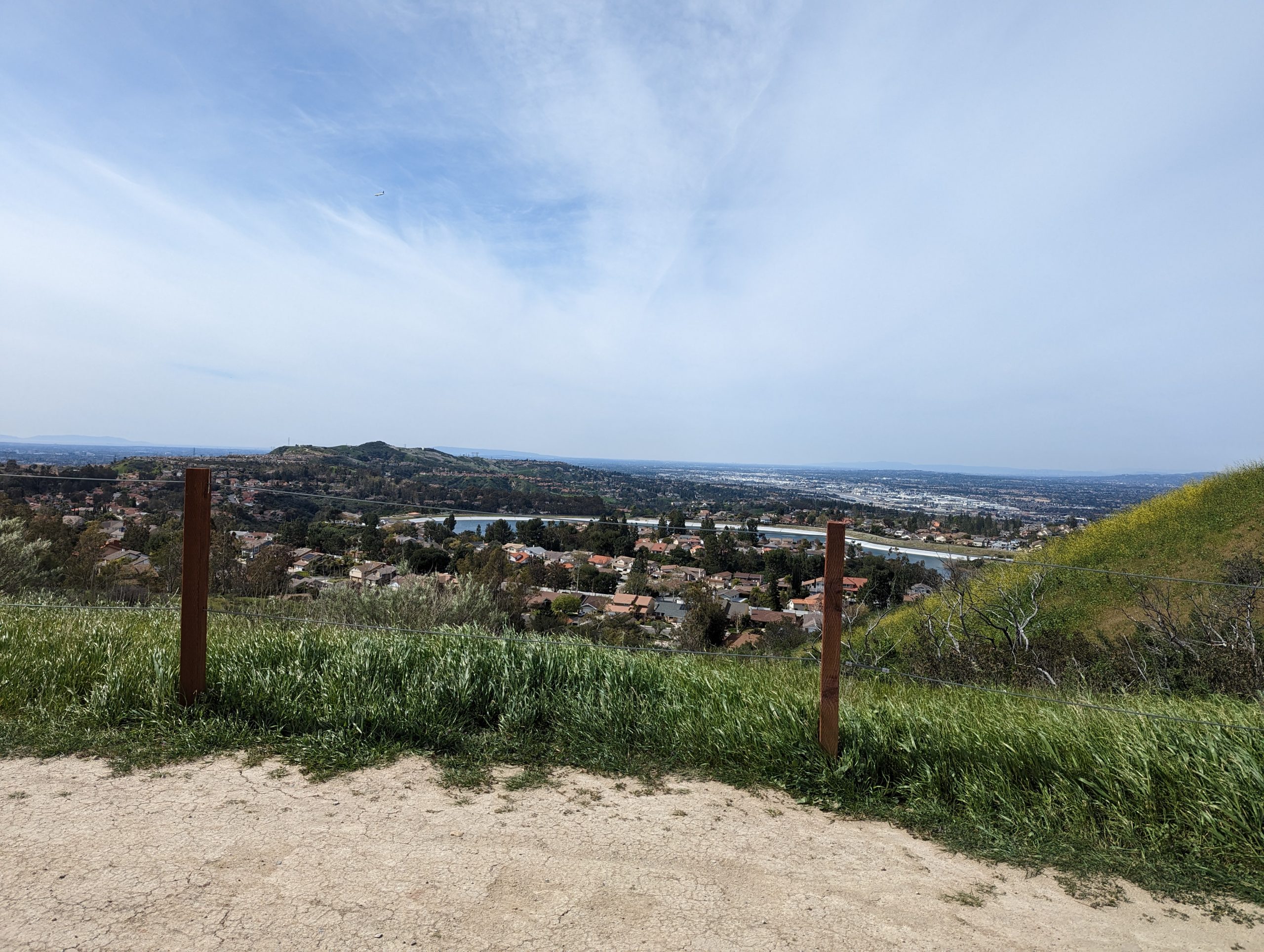
Looking out to the west from this section of trail you can see the reminder that you’re definitely in the middle of the city. Just one hillside away from millions of people.

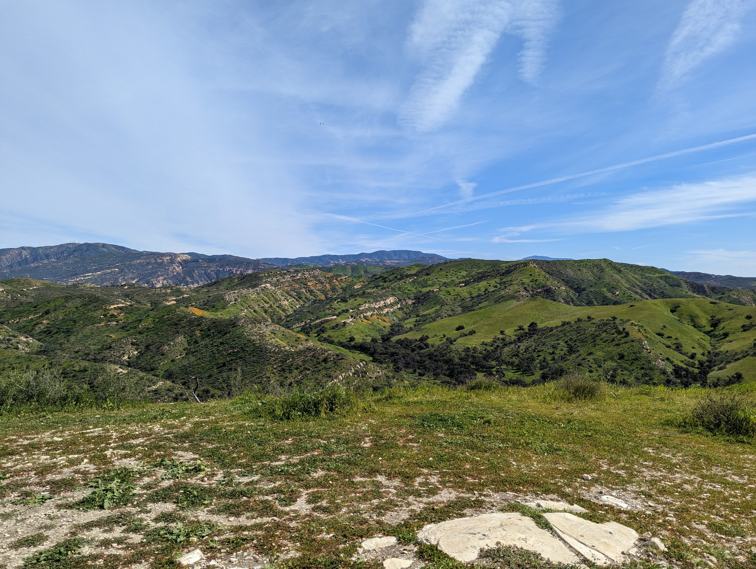
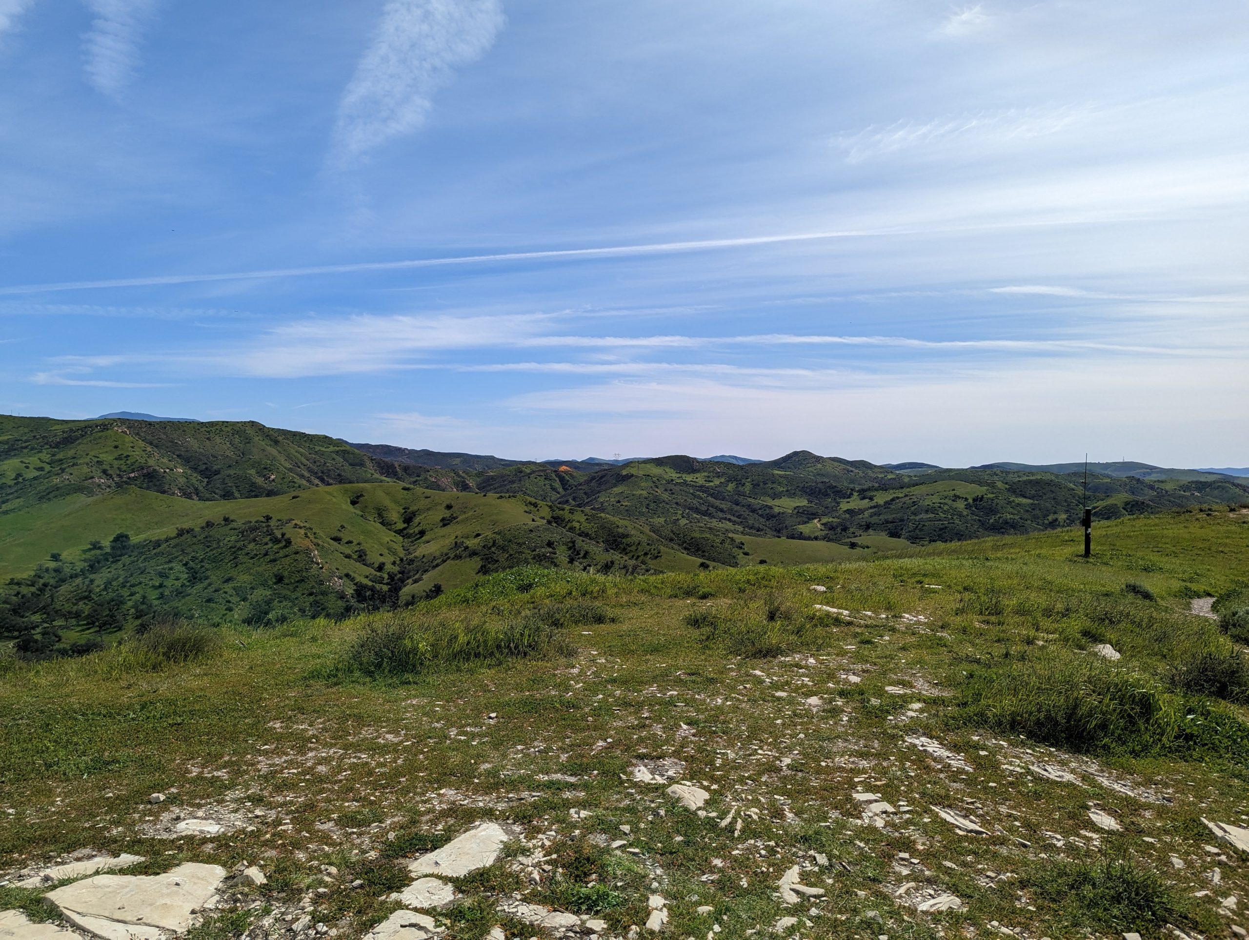
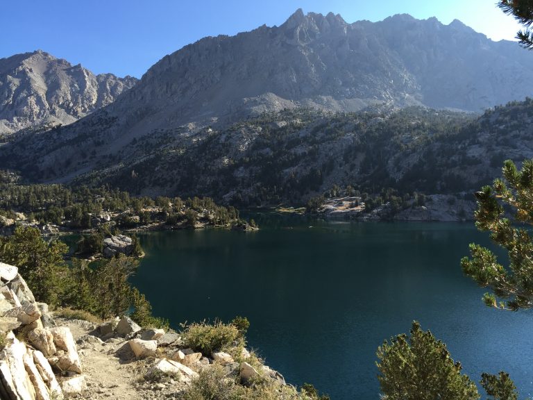
Soon after you pass the Deer Weed cutoff you will come to the highest point of the trail. If you take the short side trail to the top of the hill, you will get a nice panorama of the surrounding hill and valleys. The three photos above represent the sweeping view to the south and west that can be seen from the summit. (photos taken late February 2022)
On the way down from the summit, you will be presented with the option to take the New or Old Weir Canyon trail. While contemplating this choice, be sure to look around. On a relatively clear day you’re presented with a nice view of downtown Los Angeles.

Looking at the map, the Old Weir Canyon trail presented a shorter distance on the return trip, and since I was on bit of a time crunch to finish I took that option. As itt turns out, the old trail is not nearly as well maintained as the new one, and from research I’ve done afterwards, is quite a bit steeper. Above is a photo of the old trail, It’s about as single track as it gets, and with the good rainfall this year, was about knee high in foliage. It was also quite steep at times.
The rest of the trip back to the trailhead is uneventful, just make sure to turn “right” at the intersection back at the split so you don’t start all over again.