Cottonwood Lakes Basin
After a very successful first trip and having missed being able to sneak away in 2022 due to a mid summer National Park vacation that soaked up all our PTO (which you can read about here). We definitely wanted to head out to the back country again this year.
When looking for the next trail to take we had a couple of criteria in mind that primarily centered around the physical and mental capability of a 6 year old to manage (mostly the latter). We were looking for a hike that was 2 – 3 days in length, no more than 5 miles per day, had no extreme elevation gains and had something interesting to see/ do at the end of the trail.
We began the search by looking at the high altitude trailheads on the Eastern Side of the Sierra. We didn’t have to look far as the first one we though of was the Horseshoe meadows area. We had climbed Cottonwood pass previously and had wanted to go back and try the other trailhead in the area to the Cottonwood lakes basin.
Using CalTopo as a reference we saw that while there was some decent elevation gain overall it was only about 1000′ total from trailhead to where we thought we might camp for the first night. There are plenty of lakes in the area, although not all of them were open for fishing (Lakes 1-4 open September 1st). As an added bonus this year being an extreme snow year, there was even the potential to have snow at the end of July!
After this research we decided on 3 days and 2 nights. We would stay somewhere around Lake 1 the first night, and perhaps around Lake 3 the second. Below is the map and elevation profile from the trailhead to our first expected campsite. You can move your mouse along the elevation profile to see the approximate place on the map that corresponds to the elevation plot.
Cottonwood_Lakes_hike GPX
| Name: | No data |
| Distance: | No data |
| Minimum elevation: | No data |
| Maximum elevation: | No data |
| Elevation gain: | No data |
| Elevation loss: | No data |
| Duration: | No data |
You can see above that there’s a nice easy start, and then a medium slog about 3/4 of the way through the day. The elevation gain isn’t as bad as the graph makes it look, but there is still a solid 1000′ gain over the whole day.
Day 1 – Trailhead to Cottonwood Lake 2
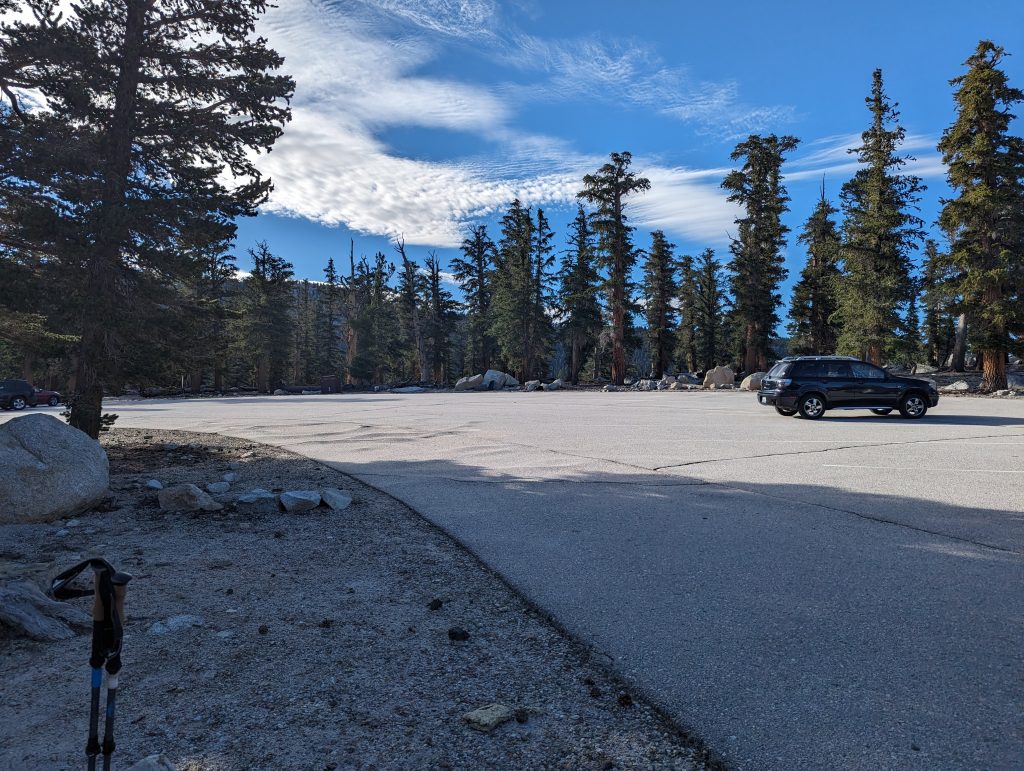
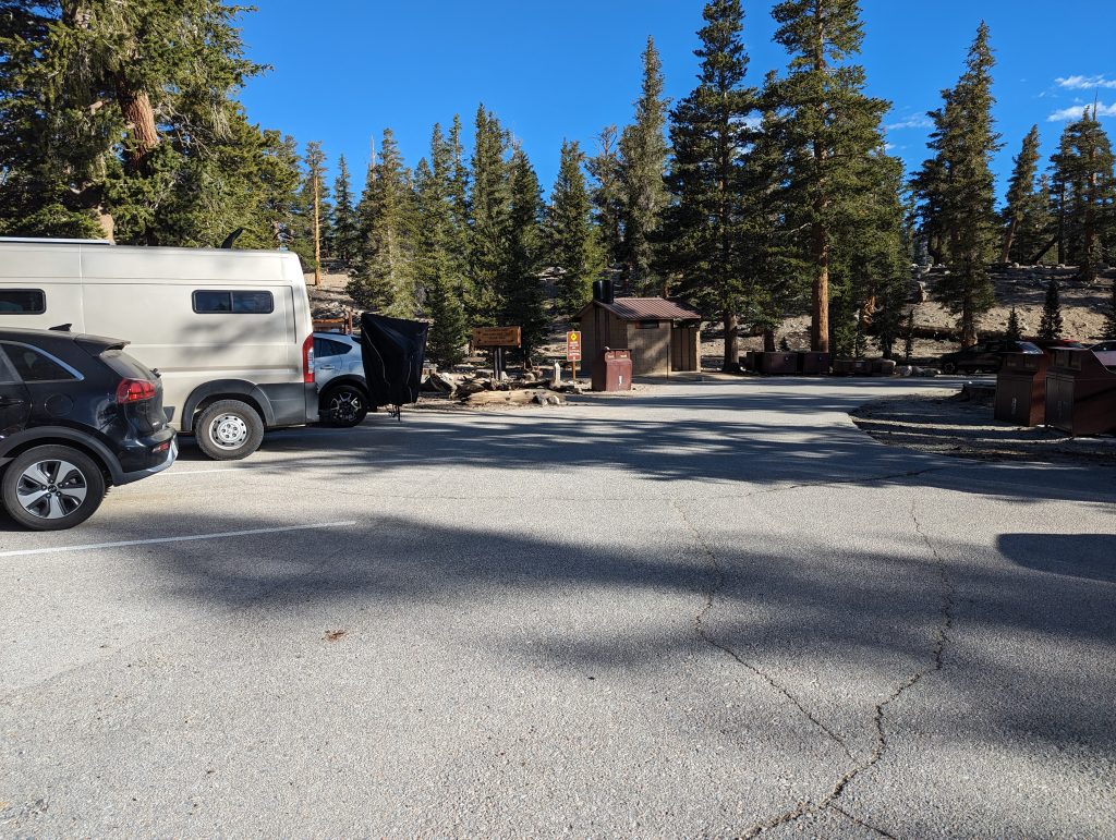
We arrived around 10pm Friday night and found the main trailhead parking lot completely full. We had planned to stay in the walk in campground to acclimate, but there was a massive bonfire going on and nowhere to park in that lot so we went around the corner to the equestrian parking lot. There were only a handful of cars there and there were plenty of campsites to choose from (although we just slept in the car). There is a small fee to stay in the campground areas. Another benefit we found out later about was the pit toilets in the equestrian lot were clean whereas the one at the trailhead was not so much.
The trailhead is only a short walk from the Equestrian parking lot. Despite the parking lot being full there were few people in and around the parking area.
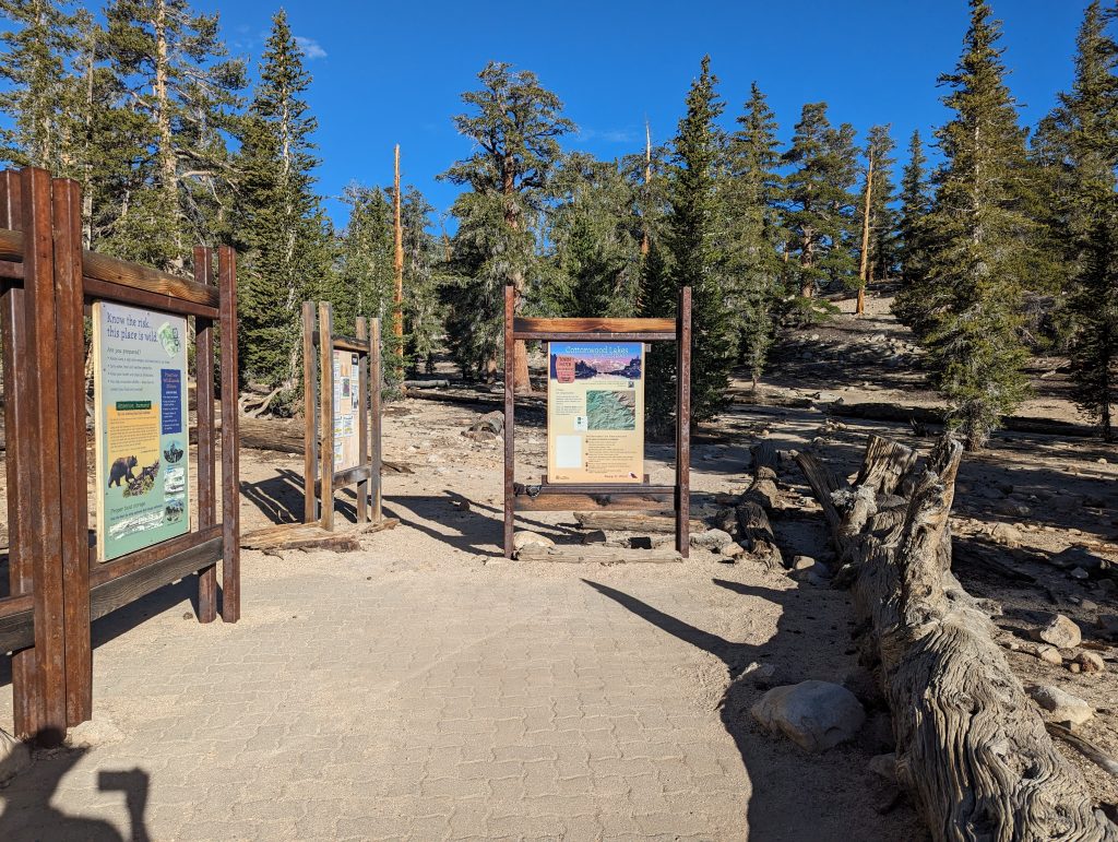
One of the nicer trailheads we’ve been to with a paved area and decently informative signs. You can see the trail begins just behind the sign on the right heading off into the trees.
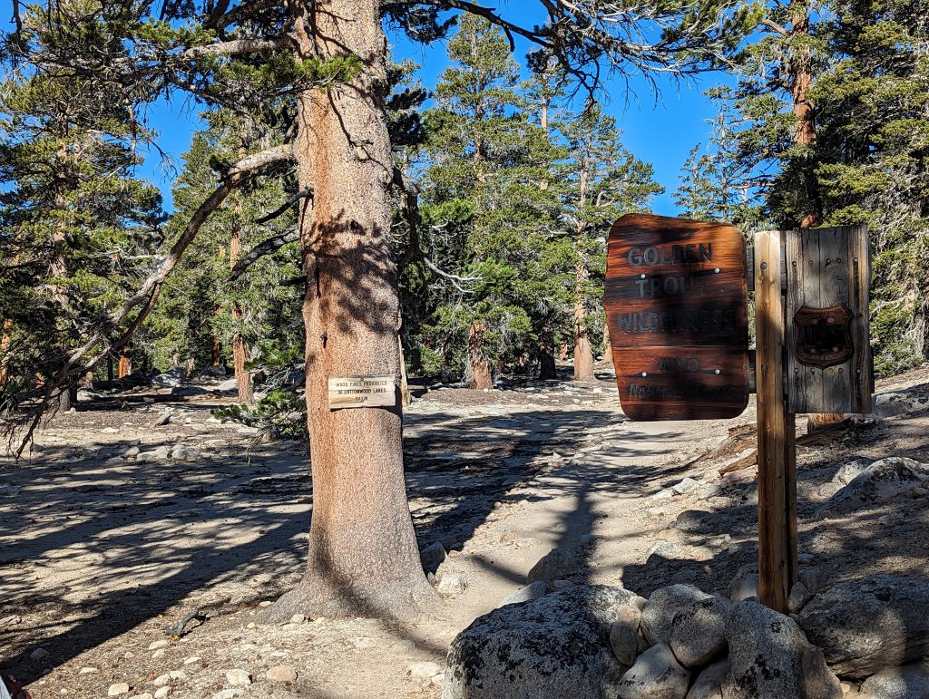
A short walk up the trail and you’re greeted with the Golden Trout Wilderness sign. Also a nice reminder that there are no wood fires allowed in the Cottonwood Lakes basin.
As you pass the Golden Trout Wilderness sign the trail very slightly rises as you head north.
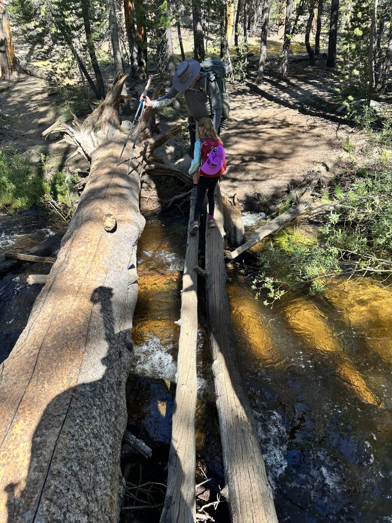
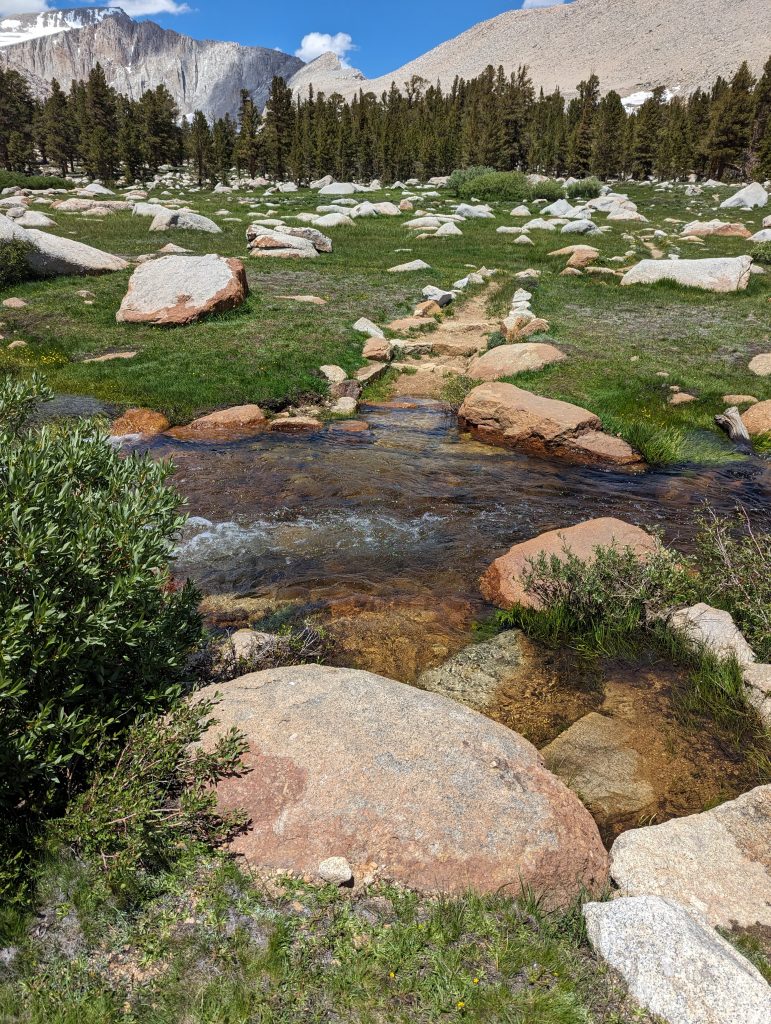
After the slight gain past the Wilderness sign, the trail crosses over a ridge and then descends through the forest for a just over a mile. In the spring, or our case mid-summer, there are plenty of pockets of flowers in the gaps of the trees to keep your eyes busy. You will eventually come to the first stream crossing. We had no option but to cross using the felled trees, which was easy since there were two of them to walk on plus a giant third one to use for balance. It did appear that the “normal” crossing point was just a bit down stream from this one and would only entail a bit of rock hopping when the water level is at a more normal flow.
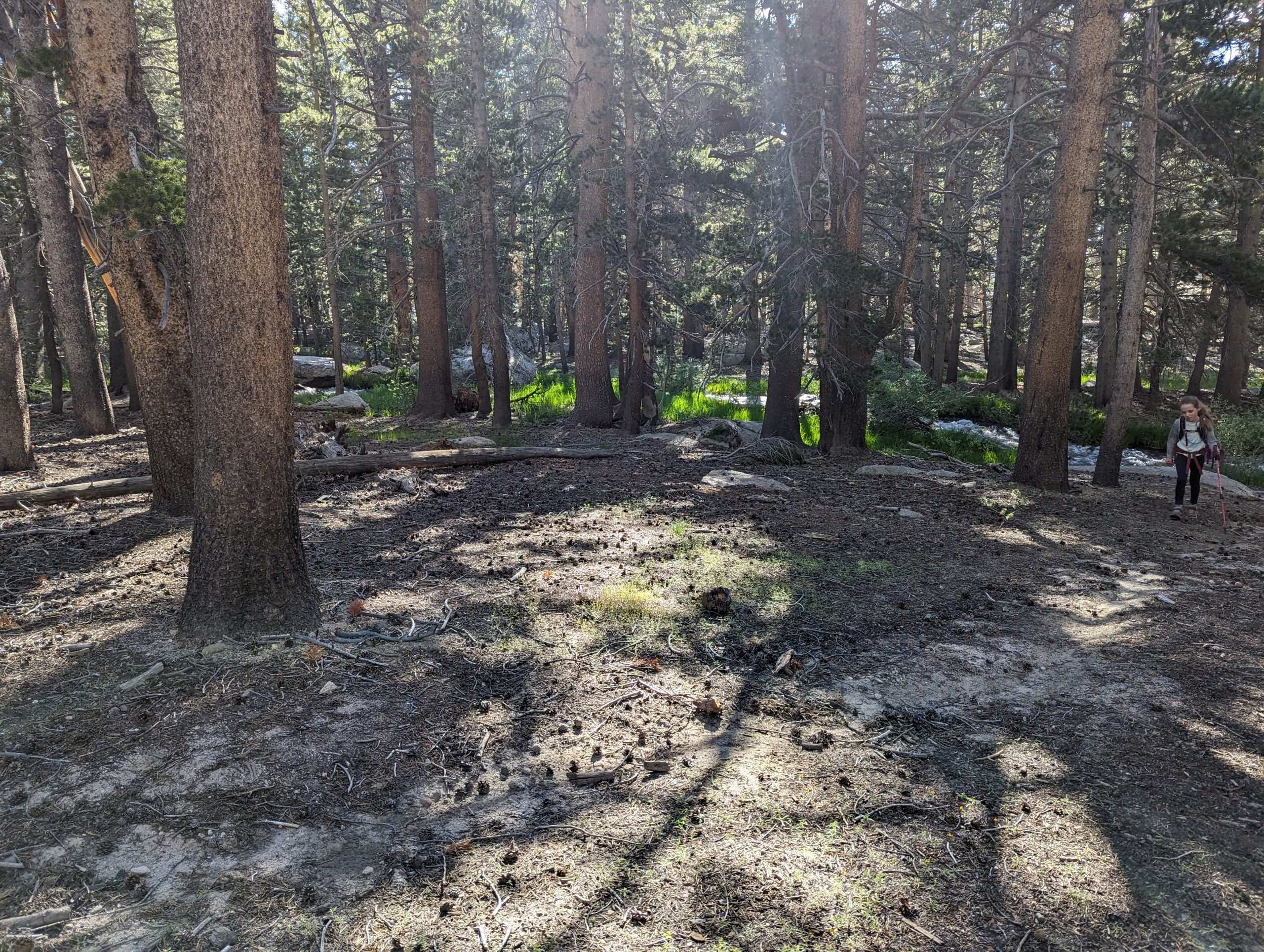
This is a view just past the previous crossing. Behind the trees the creek is running strong with the snow melt from the record breaking snowfall in 2023
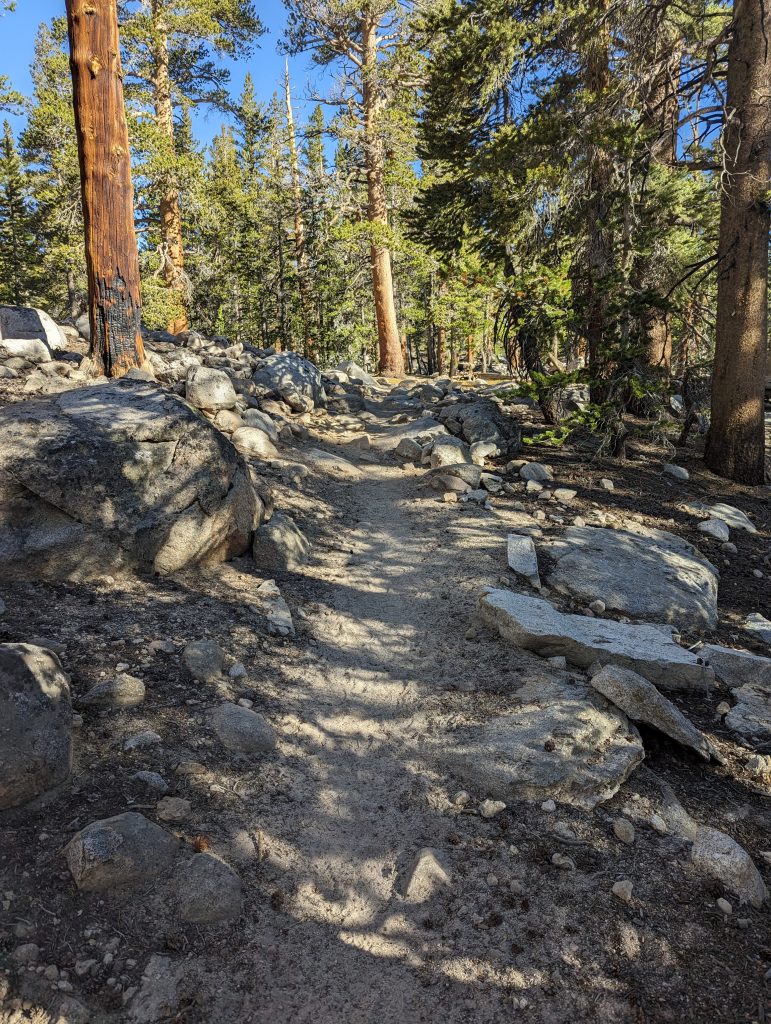
After the stream crossing you leave the trees for a bit, walking along the valley floor. The trail follows the creek for about a mile and a half before entering back to the trees and beginning the climb
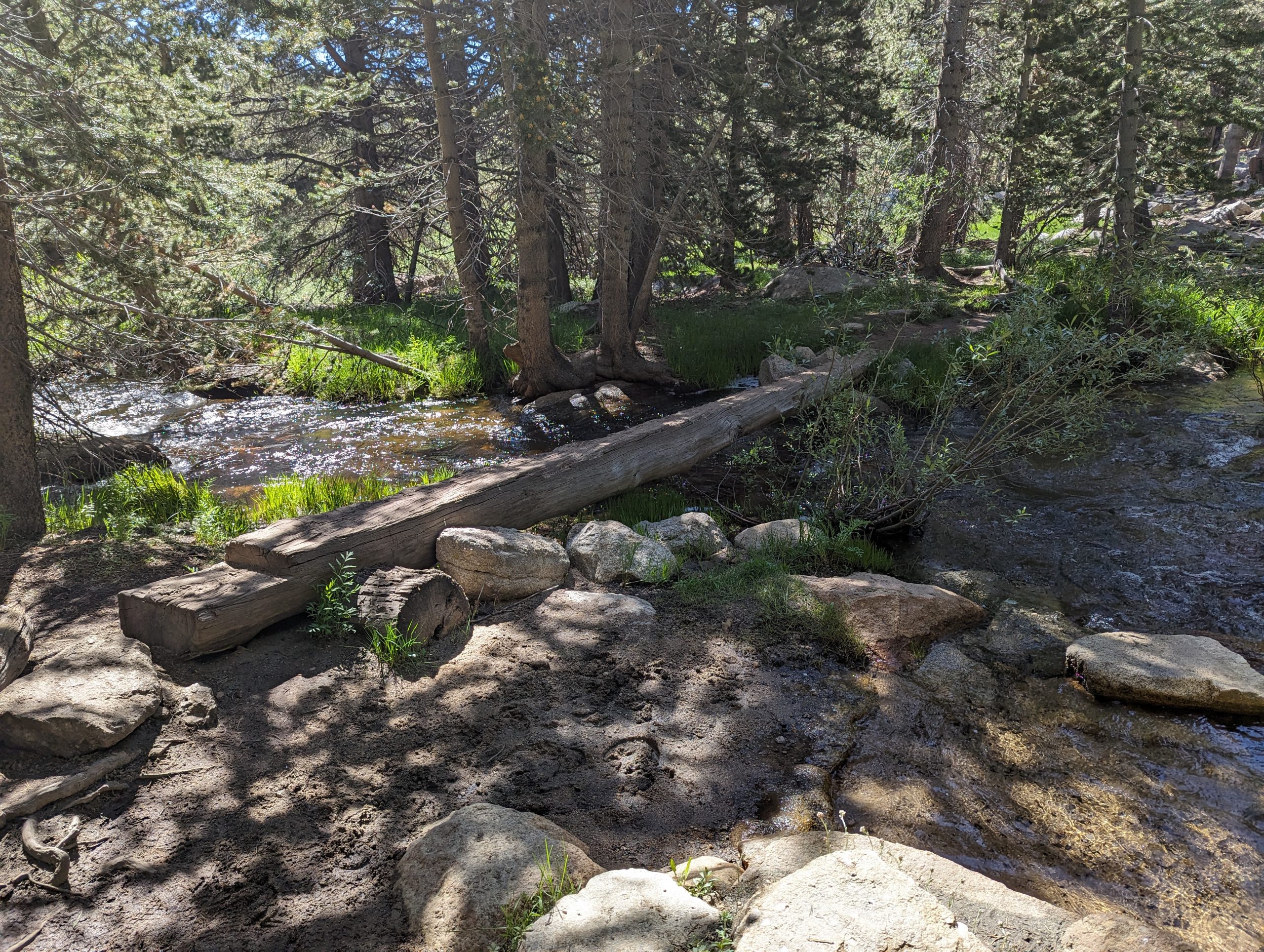
Before the climb can begin though there is one more creek crossing, there’s a nicely milled tree to cross on here.
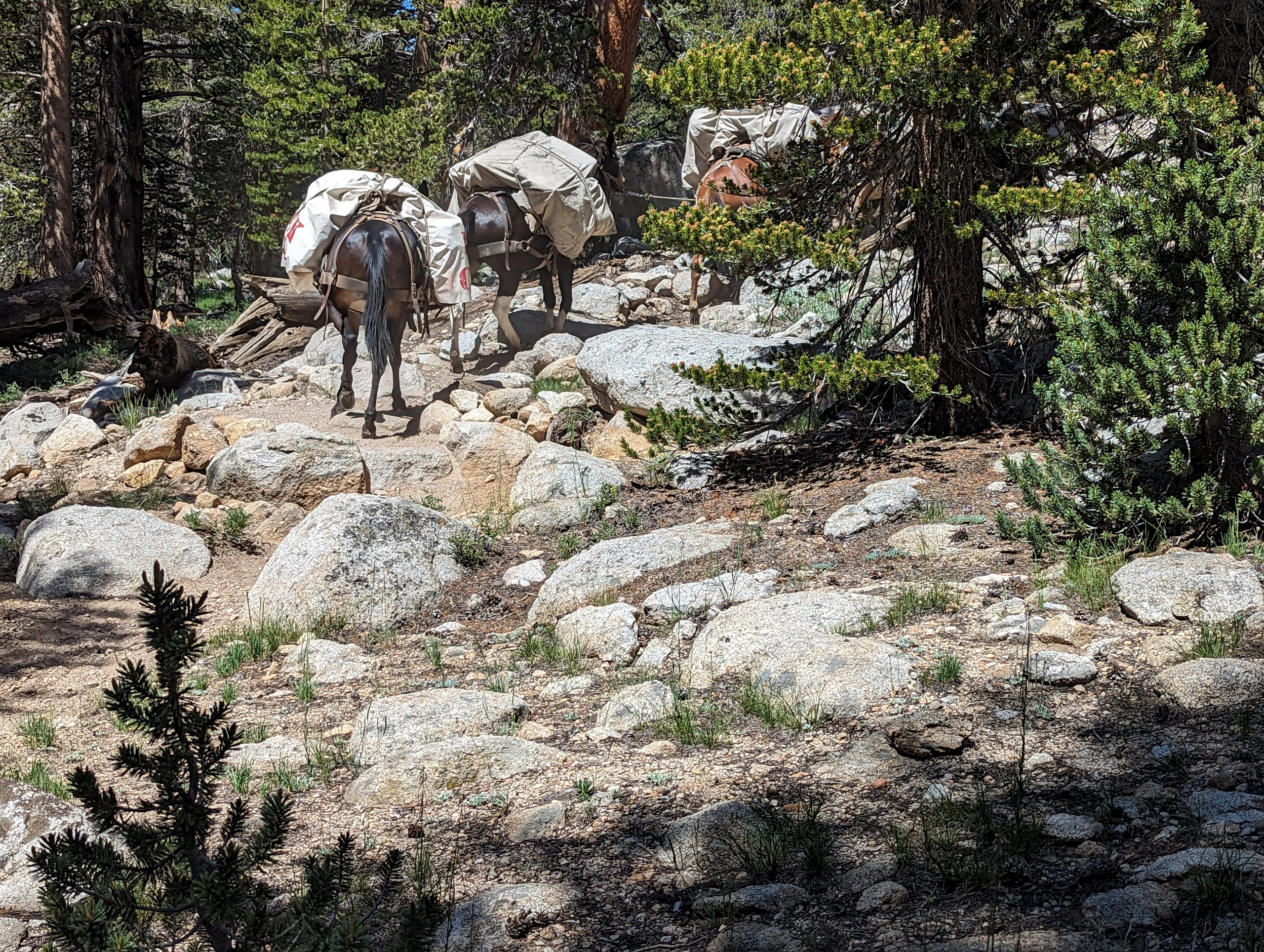
Much like on the John Muir trail, this area is used by pack trains to service customers that either need assistance, or desire to camp in a bit of luxury. We came across a group of about 9 gentlemen that desired a bit of both. About an hour after they passed us by, their provisions made their way by us. This service was provided by Rock Creek Pack Station. You might also notice in the photo that the trail has increased in steepness.
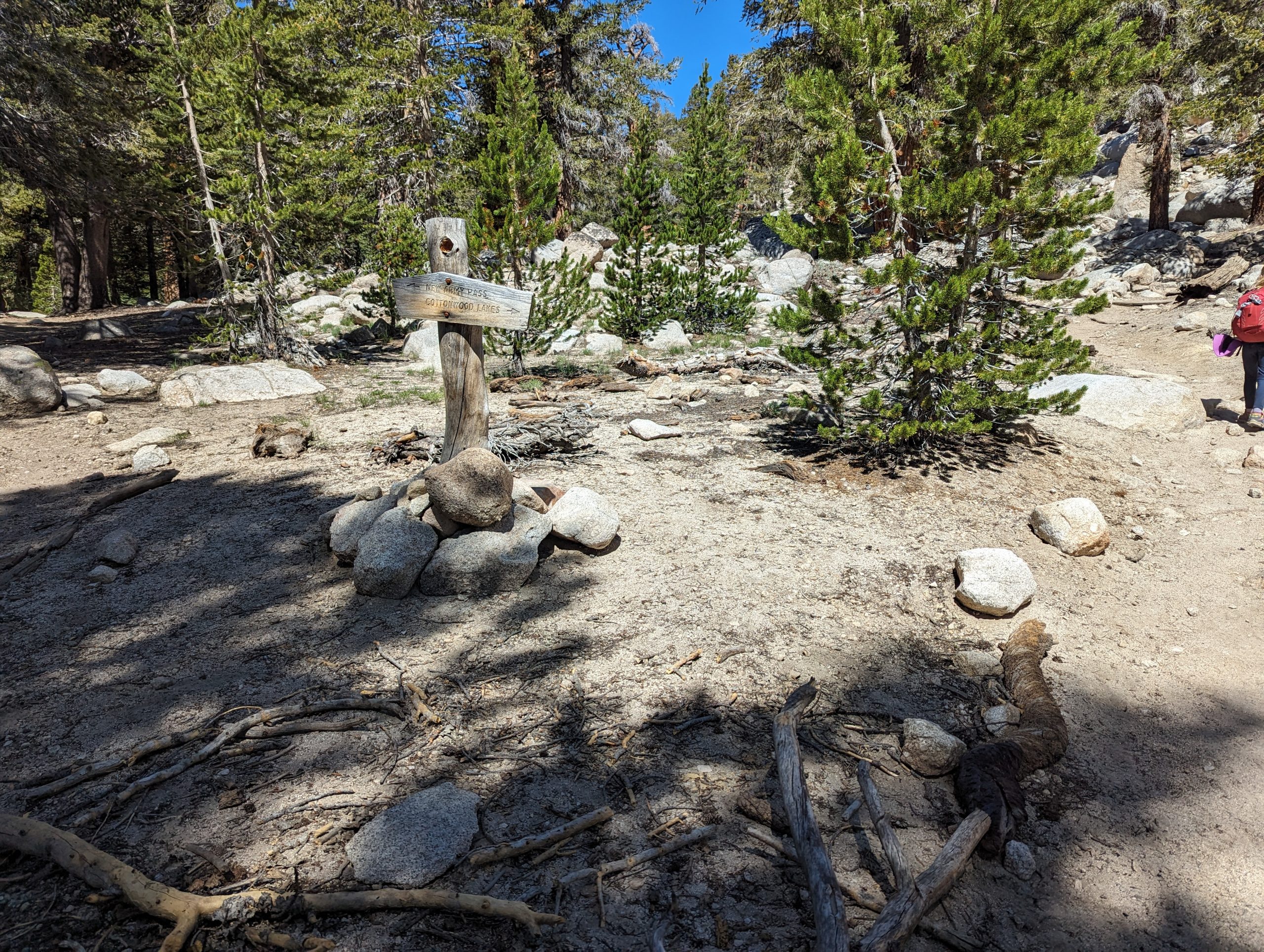
Continuing the climb there is the intersection that gives the decision to head directly to the New Army Pass, or continuing straight on to the lakes basin and Muir lake. We took the route to the Cottonwood Lakes. Hindsight, from where we camped for the first night, it might have served us better to take the left turn here.
Just under a mile past the New Army Pass turn off the trail opens up as you approach the turn off for Muir lake. You can’t make it out in the photo but this was our first Marmot (of many) sighting of the trip
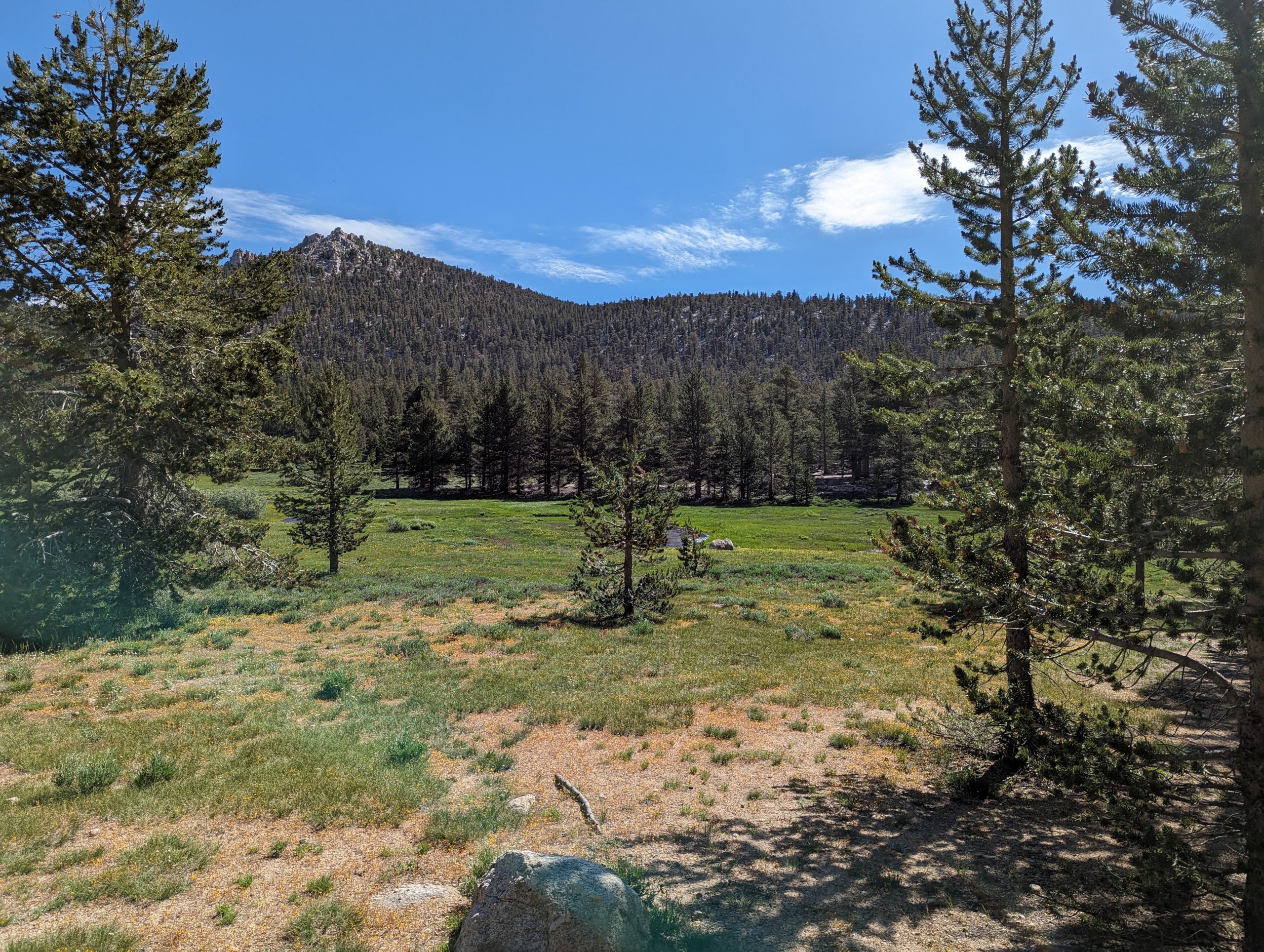
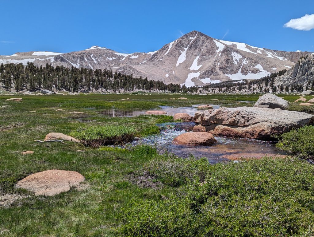
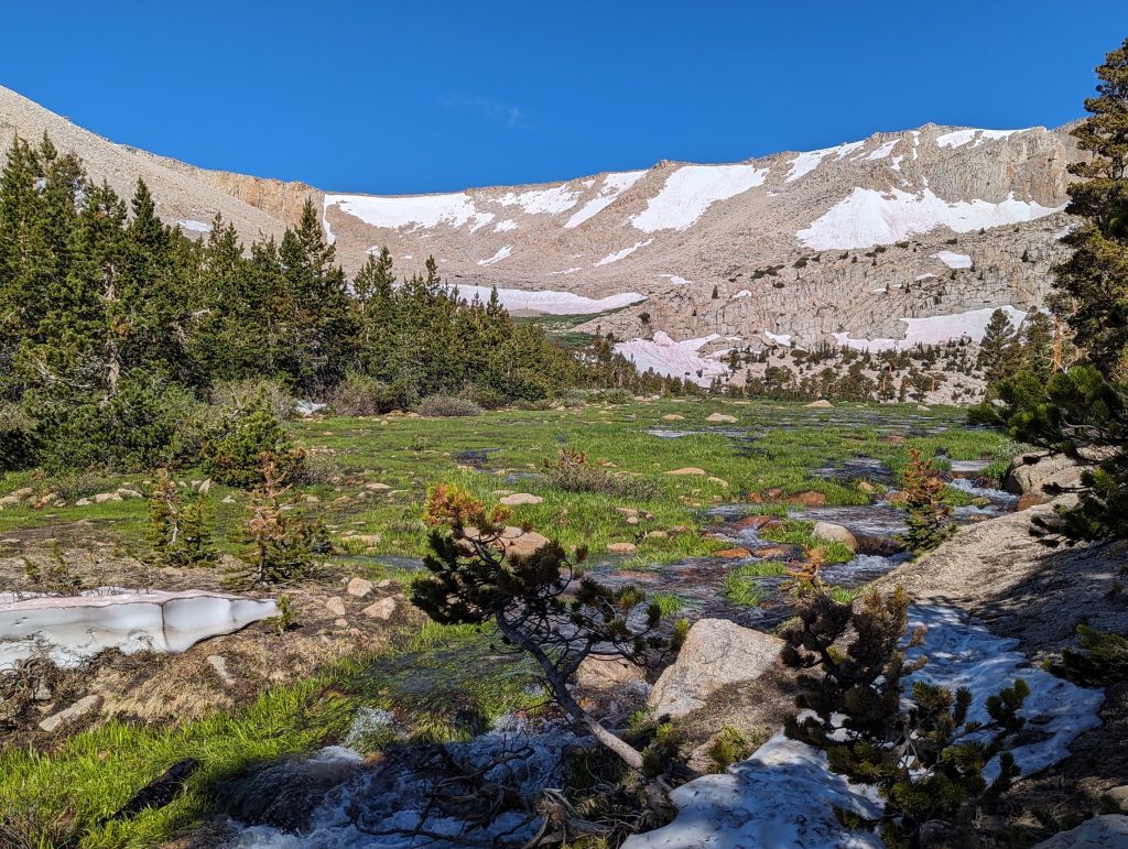
Arriving at the entrance to the Cottonwood lakes basin provides the first spectacular view of the area. This location doubles as the Muir Lake junction as well. From this point the trail flattens back out with minimal elevation gains (unless you decide to tackle one of the passes of course)
From the Muir lake junction it’s about .3 miles to the bottom of Cottonwood lake 1. We had the intention to visit Long lake and maybe High Lake (didn’t happen) so we wanted to be on the south side of Lakes 1/ 2 to facilitate that. The sign in the image points to the right in order to continue up to Army Pass but there is a faint trail to the left that crosses the creek to take you to the New Army Pass trail.
It was at this point that we found out we likely should have taken the New Army pass trail before. Thi sis the crossing at the outlet of Cottonwood Lake 1. You can see that it’s normally a couple of steps down and a couple of rock jumps for the crossing. Due to the incredible snowfall this year, even at the end of July it was over 3 feet deep and running strong.
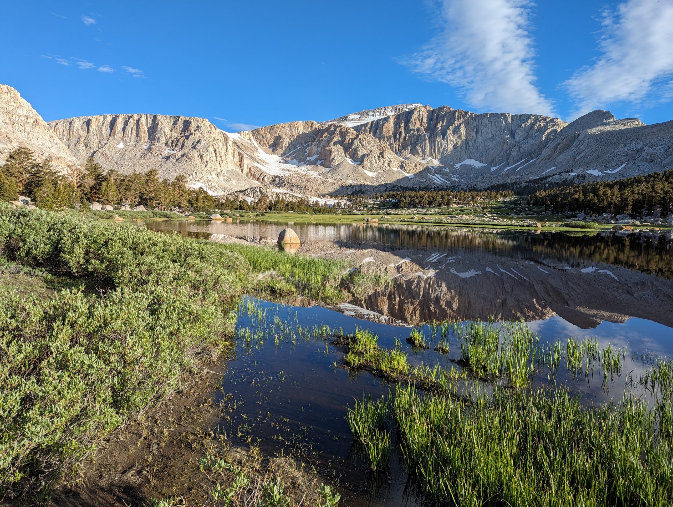
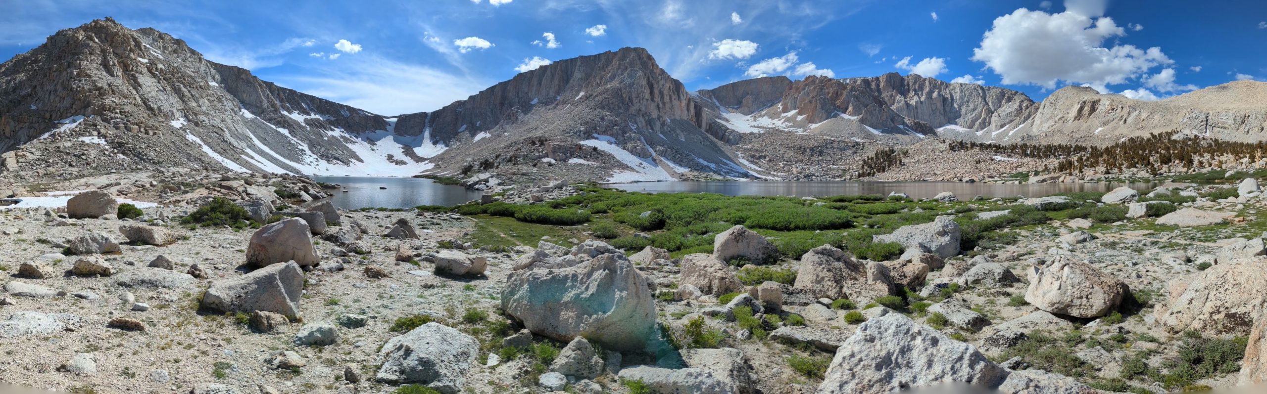
Once on the other side of that crossing though while putting our shoes back on we finally managed to look at our surroundings and see the valley that Lake 1 and Lake 2 sit in.
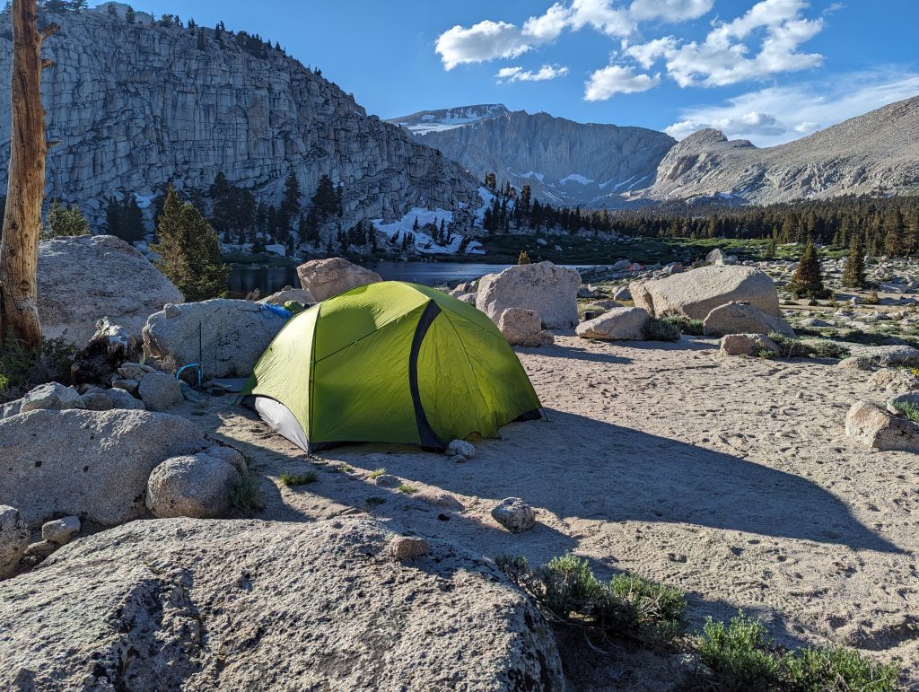
Partially due to the amount of water around and the fact we didn’t go up into the trees, there weren’t any good sites to camp on the south side of Lake 1. Continuing up 1/4 mile to Lake 2 we found a nice wide space to set up camp for the night. Unfortunately we found out after getting set up that despite our immediate tent area being clean, we were completely surrounded by Marmot feces on and next to nearly any rock.
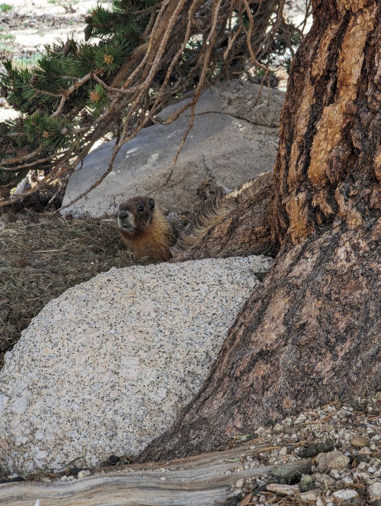
The base of a tree less than 20 yards from our tent housed the loudest marmot EVER! He was quite unhappy about our shared living quarters.
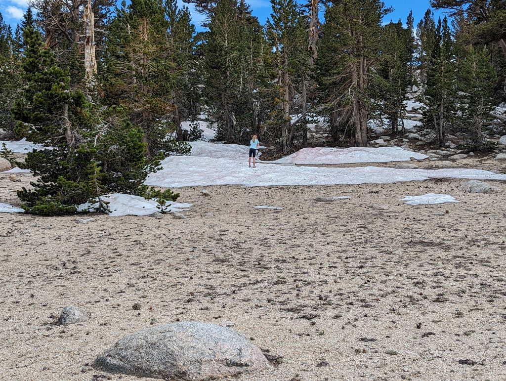
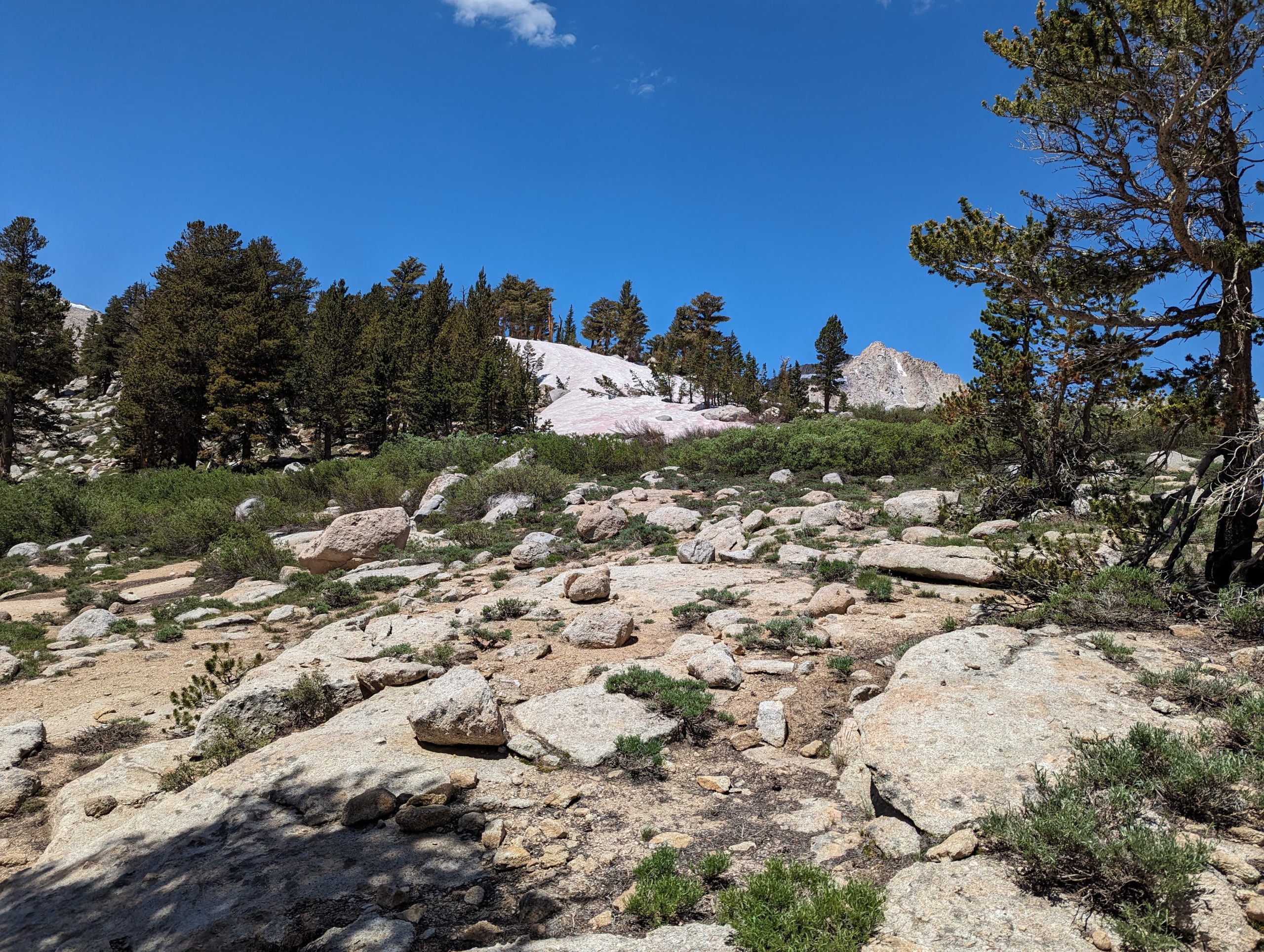
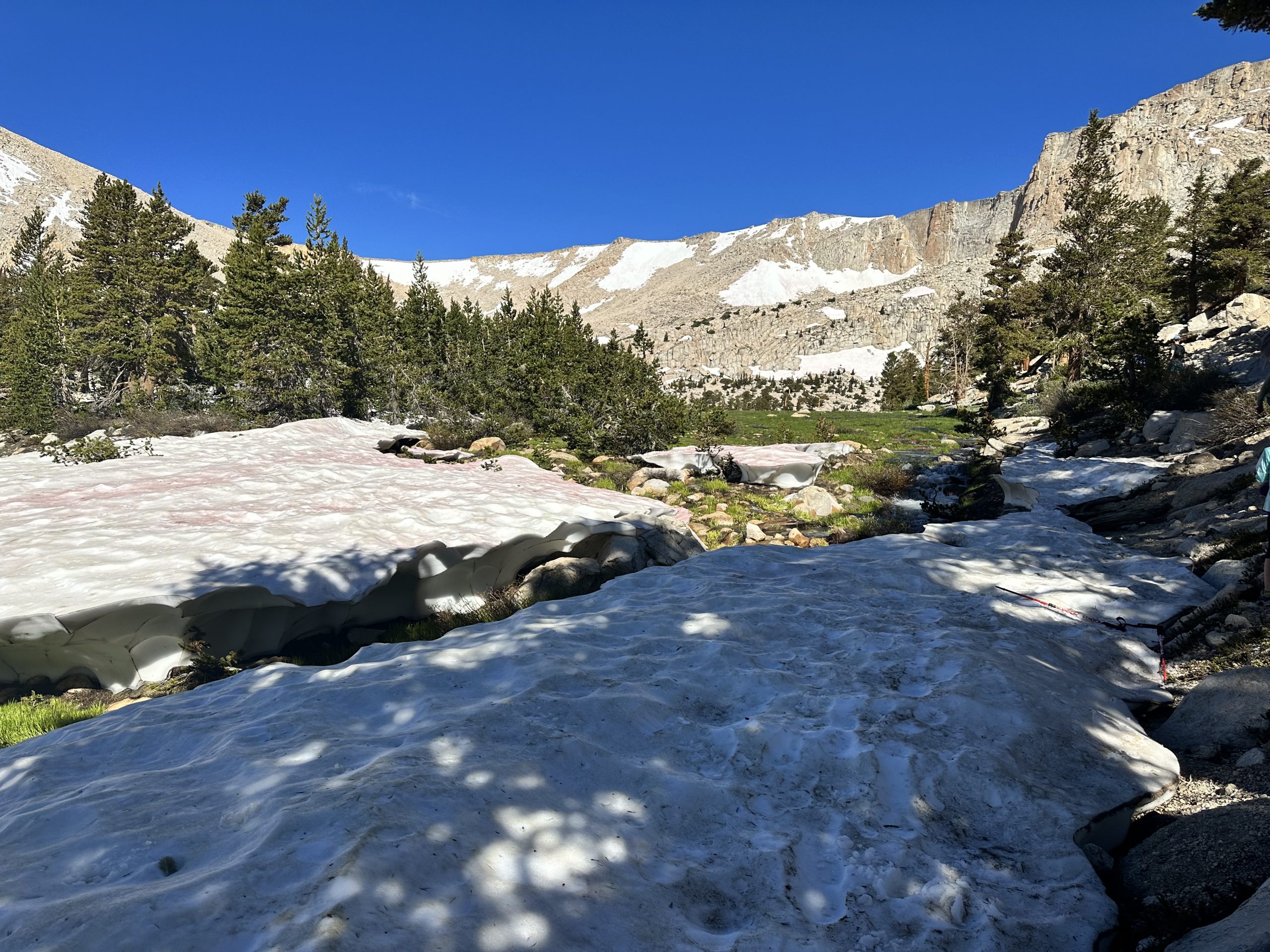
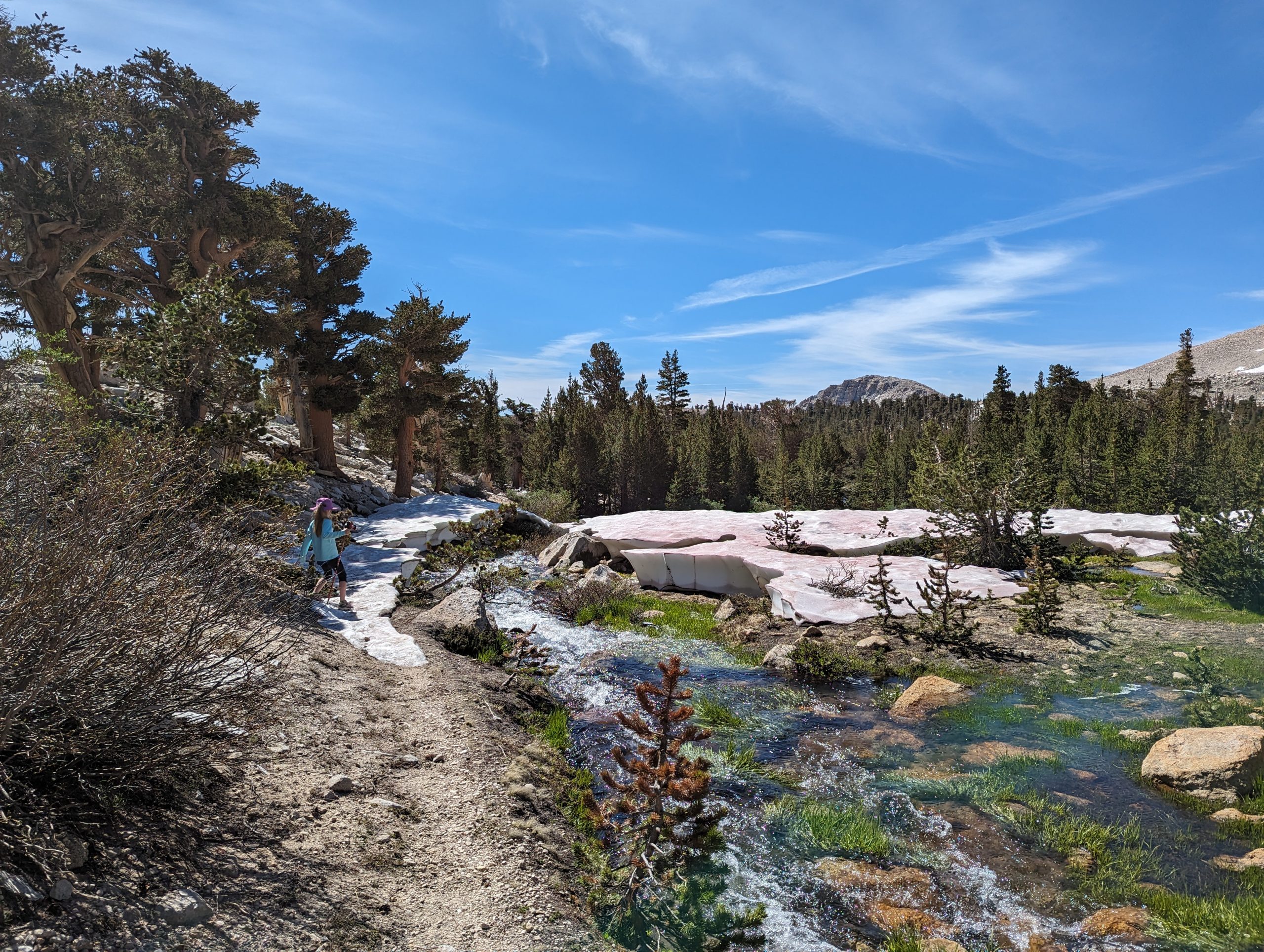
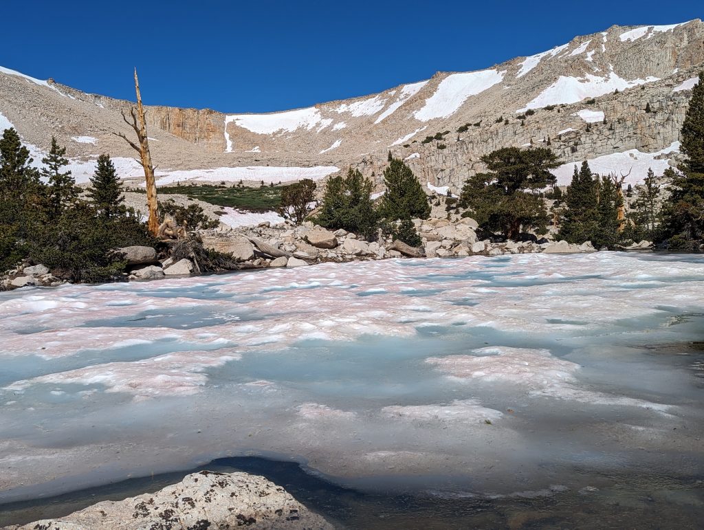
Strange site at the end of July to see large patches of snow.
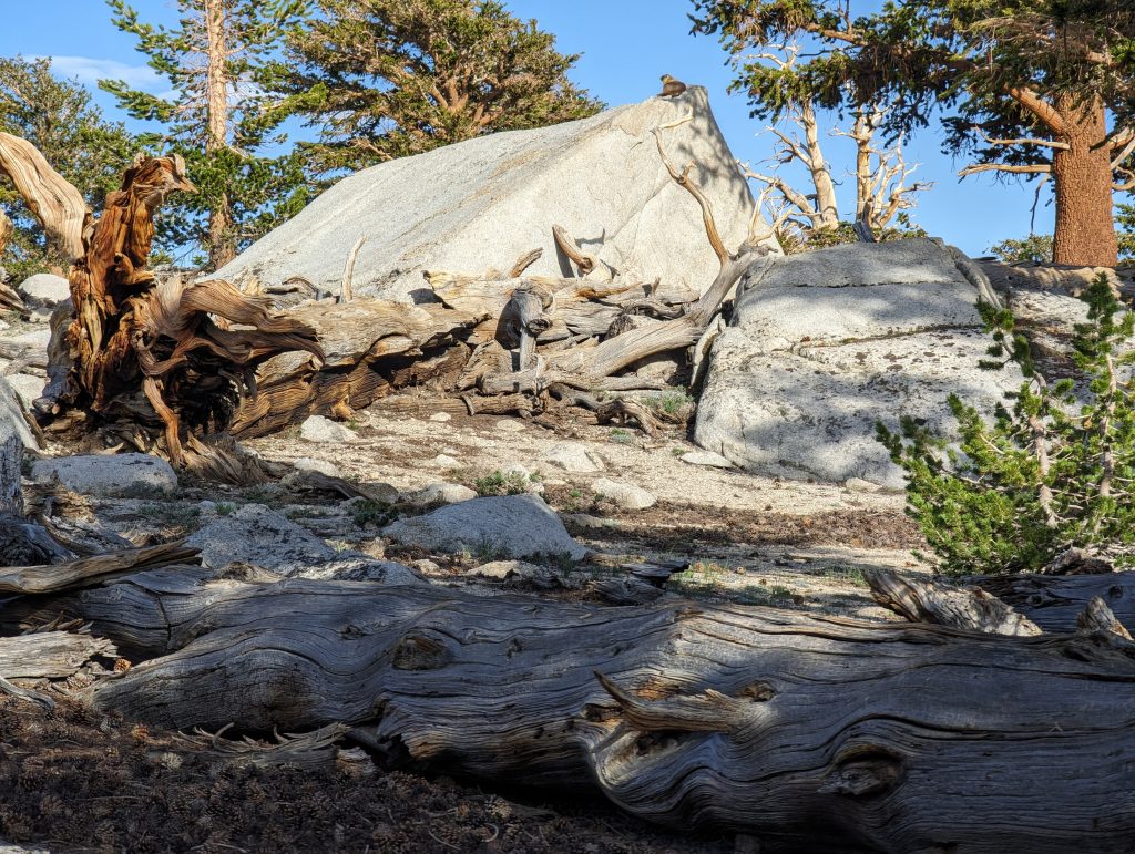
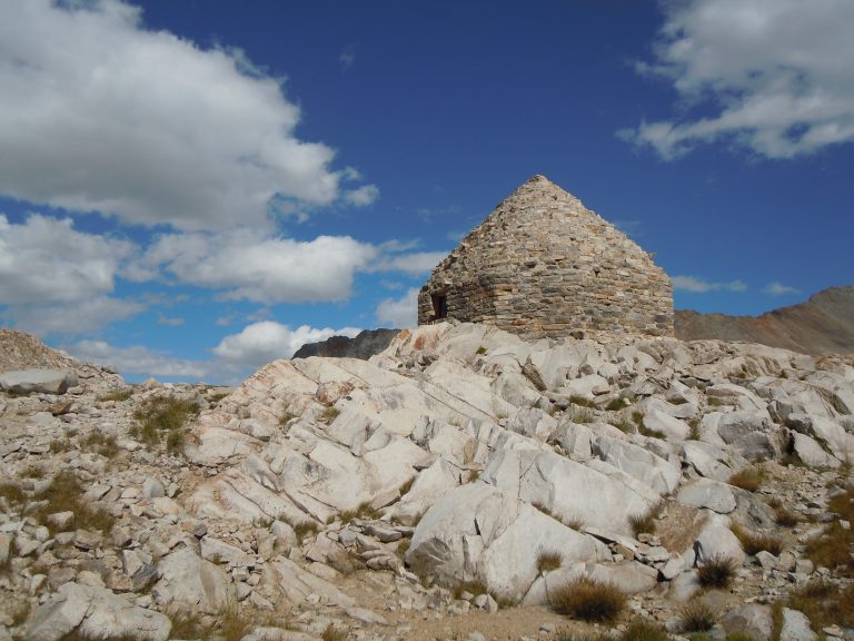
Climbing the hill behind the tent to see if we could see some of South Fork Lakes, came across this interesting rock formation. Kind of looked like an old boy school pup tent. Marmot had taken up residence at the apex of the formation.
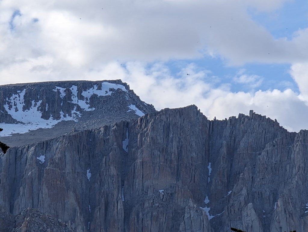
While we were relaxing in camp for the evening we noticed a helicopter circling around thepeak of Mt. Langley. We found out upon our return that a climber on Mt. Langley was injured by some falling rocks. We don’t know much information but it seems that CHP successfully rescued them.
Day 2 – Long Lake and Cottonwood Lakes 3, 4 and 5
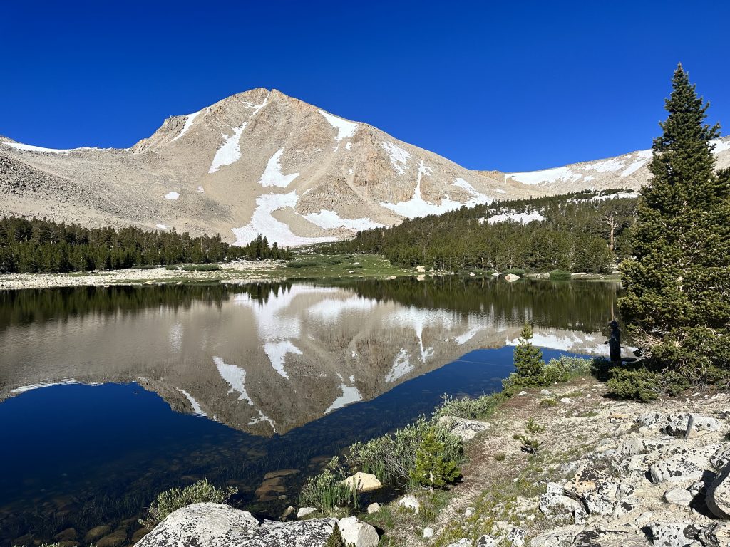
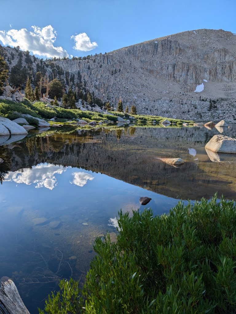
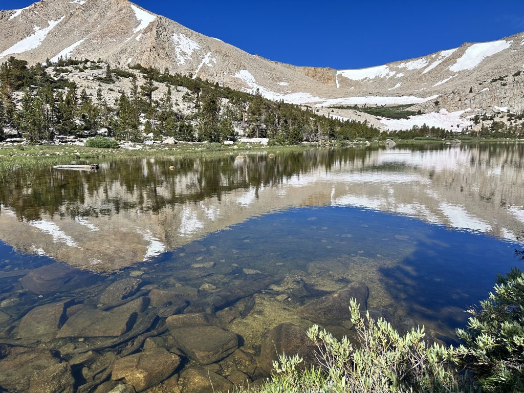
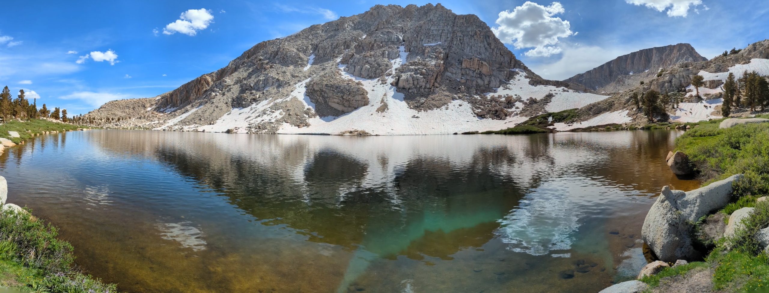
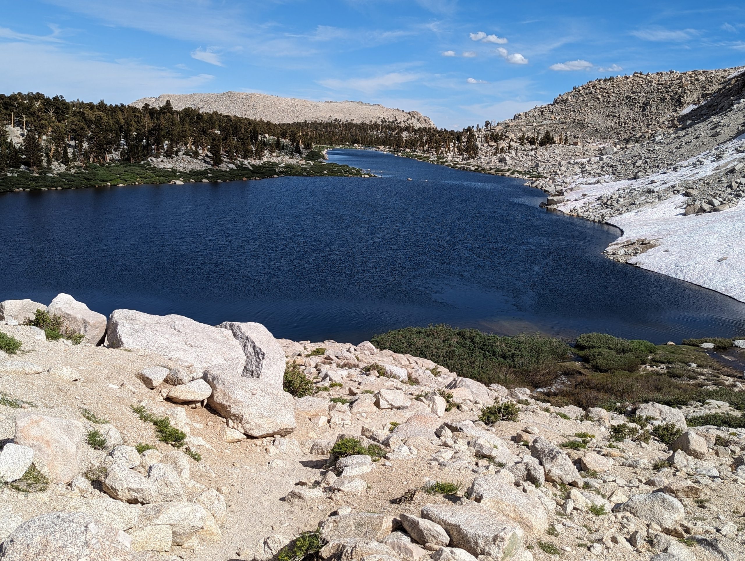
View looking up toward New Army pass and Cirque peak from the upper South Fork Lake. There was virtually no wind providing a opportunity to capture the clear reflection off of the lake. The water was crystal clear and you could easily see several 8 – 10″ Rainbow trout swimming around.
Following the trail up toward Long lake the snow was becoming more prevalent. There were times where the trail disappeared under it even. The left photo above was the location where normally the crossing is to get on the southwest side of the lake. The trail sign was nearly invisible in the snow.
Several ambitious climbers crossed this flooded meadow to get back on the trail. They had grand designs to ascend New Army pass, but we did not hear of many successful trips up.
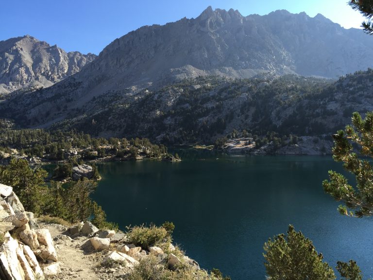
Long Lake with New Army Pass in the background. Another stunning view, with plenty of fish in the crystal clear waters.
Just over a small hill from Long lake there was a small depression that held emerald blue water similar to what is seen from glacial snowmelt. A very unexpected surprise to find this here. This was as far as we went up this valley. We didn’t feel like wading across the meadow to get back on the trail as we had planned to move our campsite.
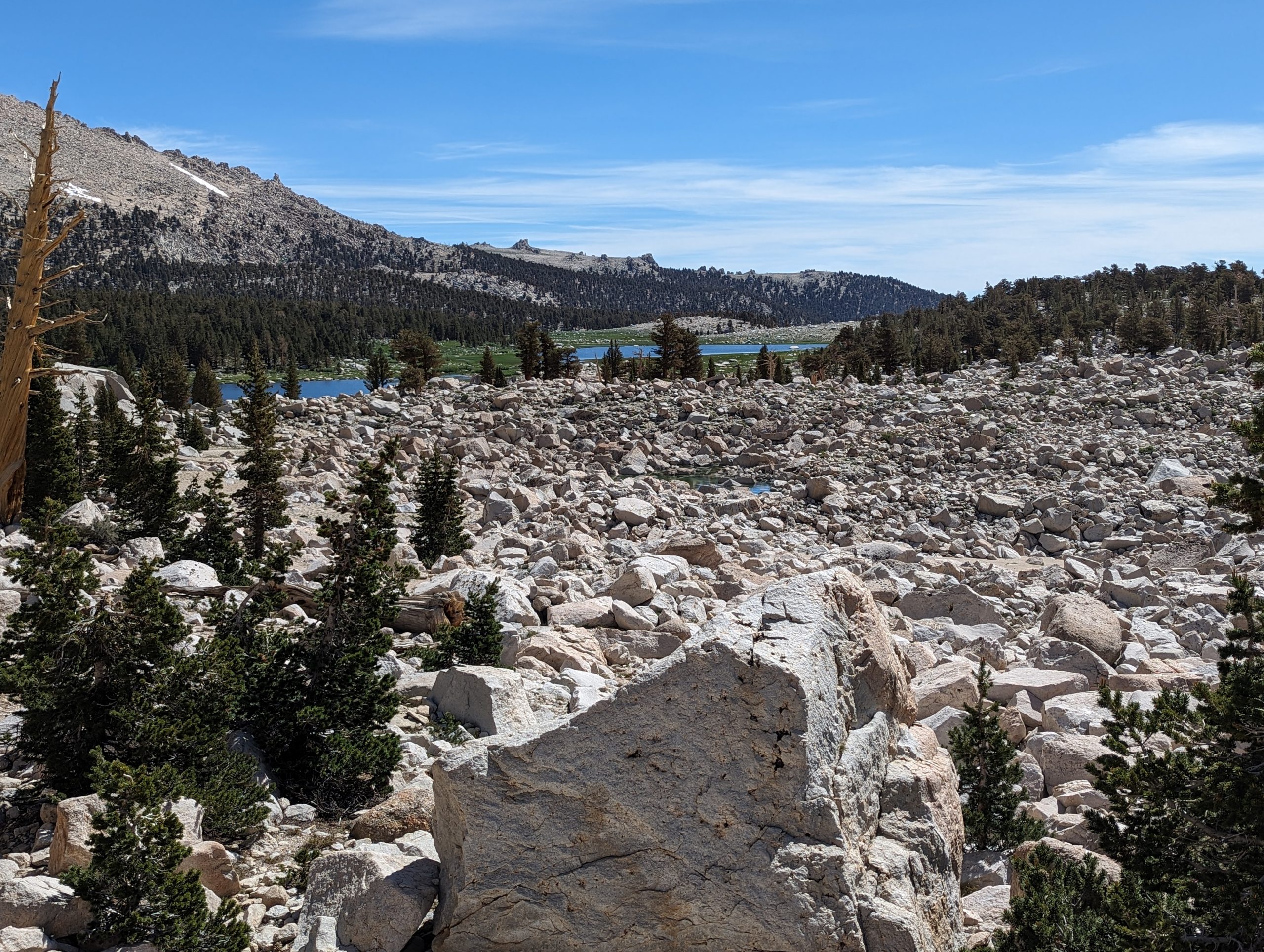
This photo was taken on the way back down toward Cottonwood Lake 1 and 2. From this vantage point you can see both lakes, as well as a small depression that is holding some water late into the season.
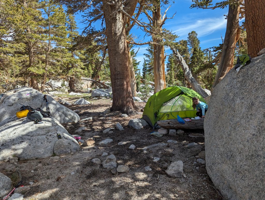
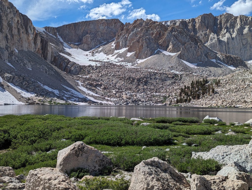
We found the trail that splits lakes one and two and took that route instead of the deep water at the bottom of the lake. Unfortunately we didn’t get any photos of it, but the crossing just had some rather wide rock hops to get across. We then hiked a bit around Lake 4 but decided not to go all the way to the top of the lake to the junction with Army pass trail. Instead we went directly up over the hill toward the unnamed lake. We found a nice shaded site, with 100% less marmot poop to set up in.
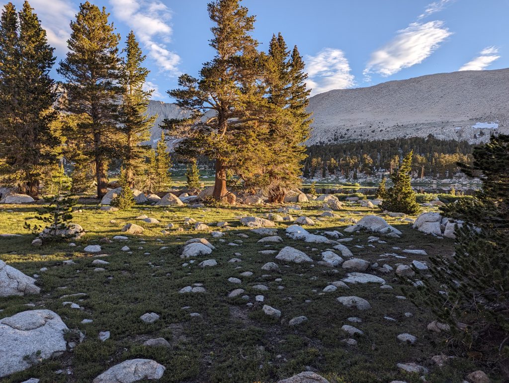
Just outside the trees we camped in was a beautiful meadow studded with rocks that lead down to the unnamed lake.
The view up the valley to Army pass was every bit as dramatic as the New Army pass side.
After camp was set up we took off to explore/ find Lakes 4 and 5. The trail was flat until the last 1/8th mile down to the head of Lake 3 where it went downhill. We never did find the junction to the trail that skirts the shore, but we also didn’t spend any time at all looking for it. on the right side of the image above you can see the snowfield with a trail going up to the left. This is the way to Lakes 4 and 5.
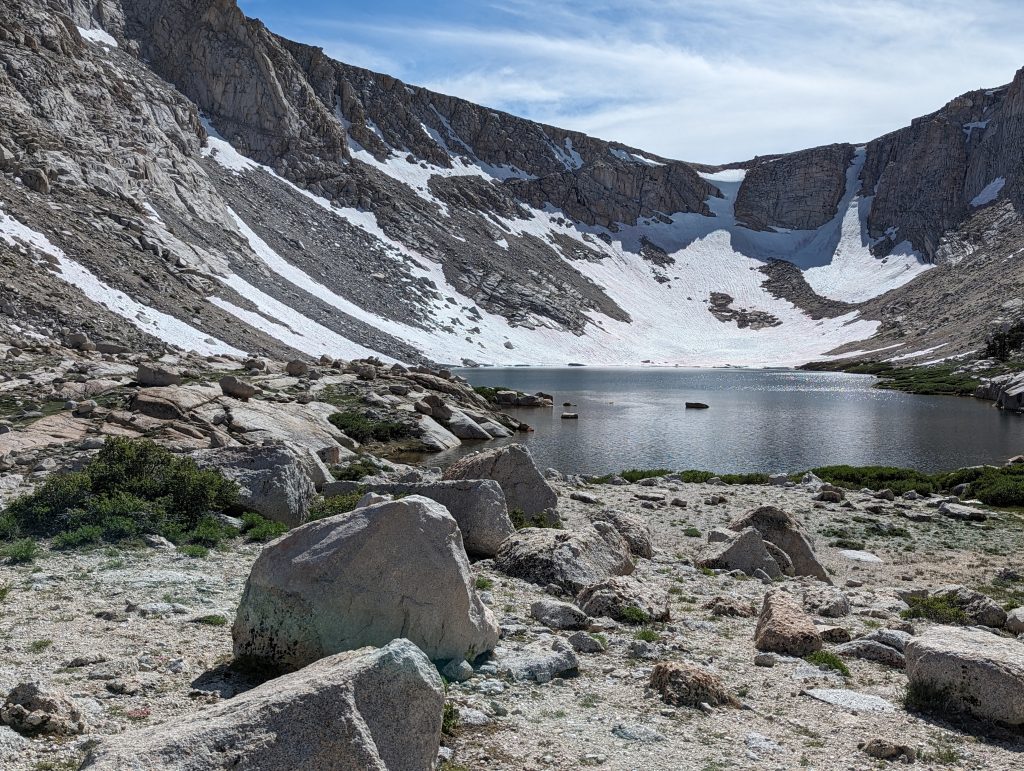
From the head of lake 3 the climb to the other lakes isn’t too tough. The snowfield in the late afternoon made it a bit more challenging than it needed to be. The view of the upper lakes made it well worth the effort. Army pass was still very much not passable due to the snow that was clinging to it. it does appear that if you really wanted to climb the snow chutes you might be able to do it, but one mistake would be disastrous.
Panoramic view of lakes 4 and 5. There must have been some artifacting on the lens to make that green tint on the rocks in the foreground.
This is the view of Cottonwood lake 3 from above the snowfield looking down the length of the lake. After this we just returned back to camp for some well deserved dinner and rest.
Day 3 – The Hike out
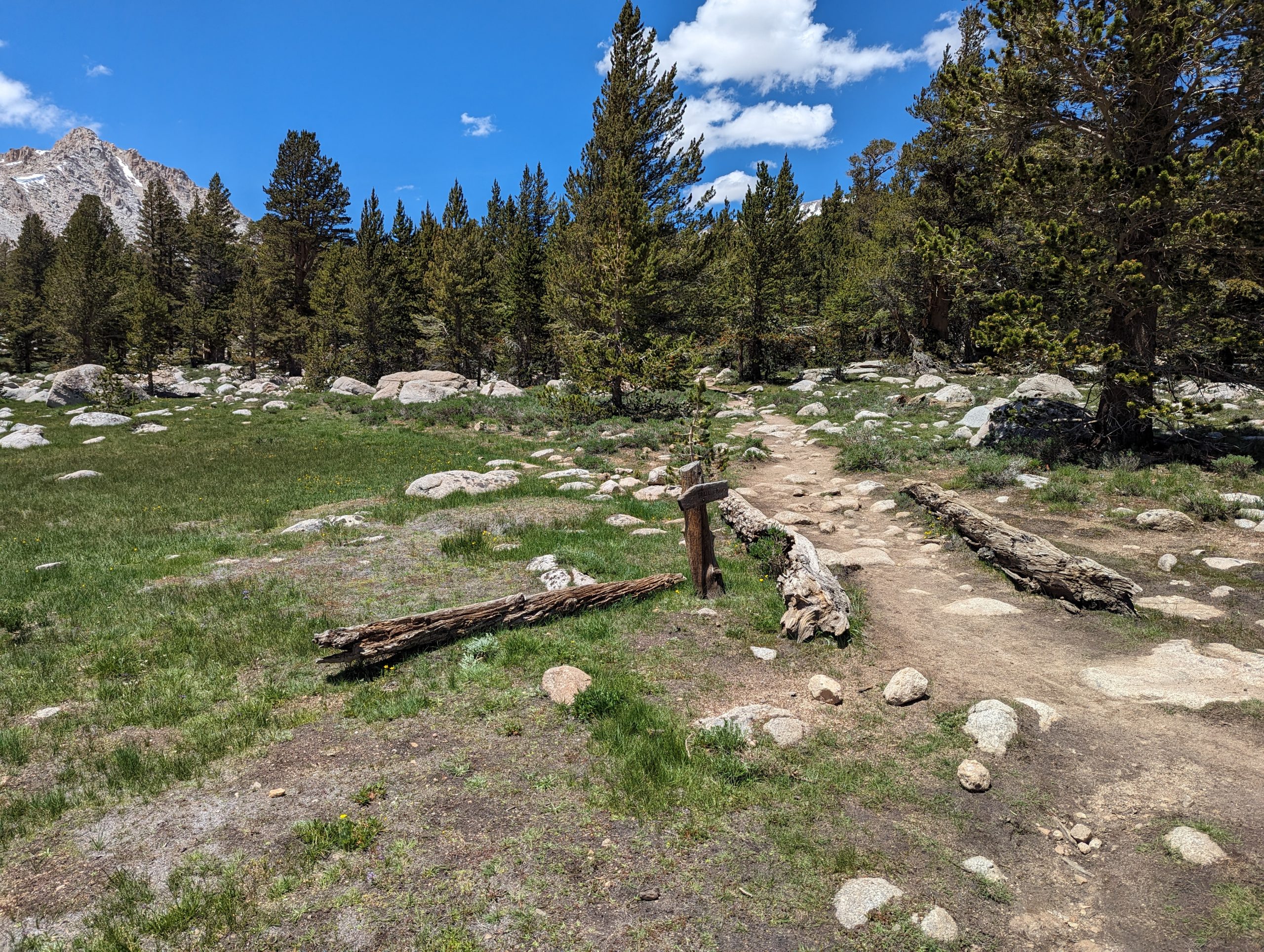
That would be the end of the adventure in Cottonwood lakes basin. The next morning we took the northern trail along unnamed lake and the trail crossed the stream in a stunning fashion just before the bottom of lake 1.
The rest of the way back to the trailhead was rather uneventful for us outside seeing a grouse family near the Muir Trail Junction.