Overnight Backpack to Little Jimmy Trail Camp via Windy Gap Trail
Important information: This hike and photos were in 2012, the Little Jimmy Trail Camp area has since been impacted by a large wildfire in 2020 (Bobcat Fire) Link to affected area
- Overnight Backpack to Fern Lake – 100% Cell Service!?
- Icehouse Canyon to Chapman Trail Loop
- Hiking Mt. Baden Powell via Vincent Gap
- Chicken Spring Lake via Cottonwood Pass
- 5 Mile walk around Bonelli Park
Table of Contents
Little Jimmy Trail Camp (click link for current status) is a developed campground situated just off the Pacific Crest Trail. At 2.8 miles the hike to Little Jimmy Trail Camp, while not long in distance, is very exposed and at times has some relatively serious elevation gain. It is best attempted either in the very early morning or during the shoulder seasons of early spring and late fall as the sun exposure is very strong and the temperature can get very hot in the summer and being on the sout facing slope has snow in the winter. There is no water on this trail from the time that you leave the trailhead until you reach the spring near the campground.
Directions
There are a couple of ways to get to Little Jimmy trail camp. Living in the east San Gabriel valley, we chose the route up the Windy Gap trail. This is the longer hiking route, but shorter in distance from those in the eastern Los Angeles and western San Bernardino county area. It’s located near the road closure at the top of Highway 39 and is just adjacent to the Crystal Lake store and campground
To get to this trailhead, make your way to the 210 freeway, exit on Azusa Avenue and head north. Quickly after you exit the freeway and begin north, the road will become a one way street. Continue to follow it north until you reach the entrance of the canyon. Once entering and heading up Azusa Canyon, keep going uphill and be sure to watch out for the many cyclists punishing themselves, and sometimes you, with their slow ascent of the canyon. You will eventually come to East Fork Road and its bridge that goes to your right, do not be tempted to turn, instead continue straight on to Crystal Lake.
After several more miles, you will reach the turn off for Crystal Lake road located on your right side. If you hit the locked forest service gate, then you have gone too far and must turn around and proceed down the hill a short distance.
Follow Crystal lake road until you reach the cafe on your right. Do not park at the cafe, instead continue up the road another 1/4 mile or so until you get to the parking area for the Windy Gap Trailhead.
Trail Description
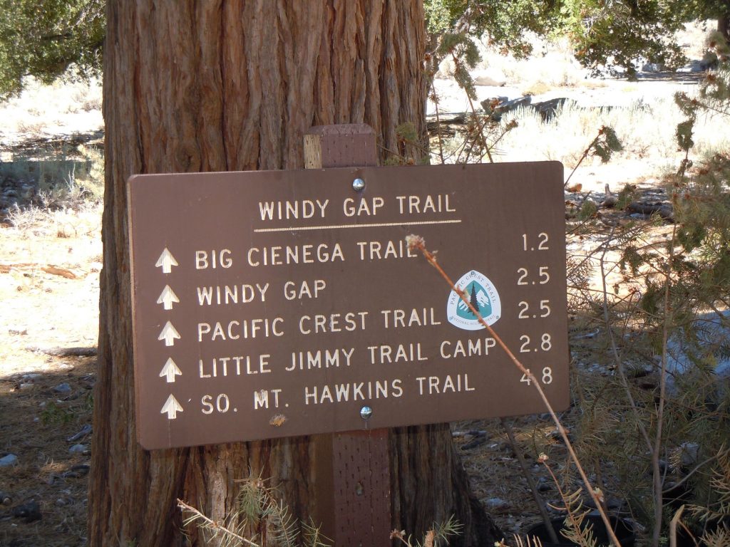
From the parking area you will find the trailhead across the street. You should quickly be able to find the sign marking it, along with mileages to different spots along the trail. The first mile and a half or so of the trail, until you are just past the Big Cienega Trail cutoff, winds gradually through forested areas and is generally a pleasant hike.
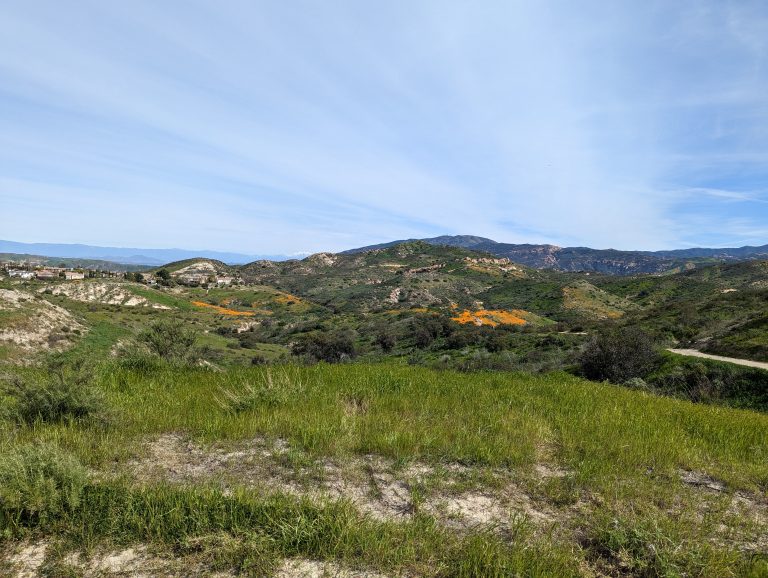
After this point you begin to enter an the burn area of the 2002 Curve fire. This is the part of the hike where, if you’re hiking in the late spring/ summer season like we were, you begin to feel the sun on your neck as the trees no longer provide shade, but are just there as solitary reminders of what once was a magnificent forest. Unfortunately this section also corresponds to the portion of the trail that experiences a relatively significant elevation gain. This is where the last push to Windy Gap occurs, our highest point on this particular excursion.
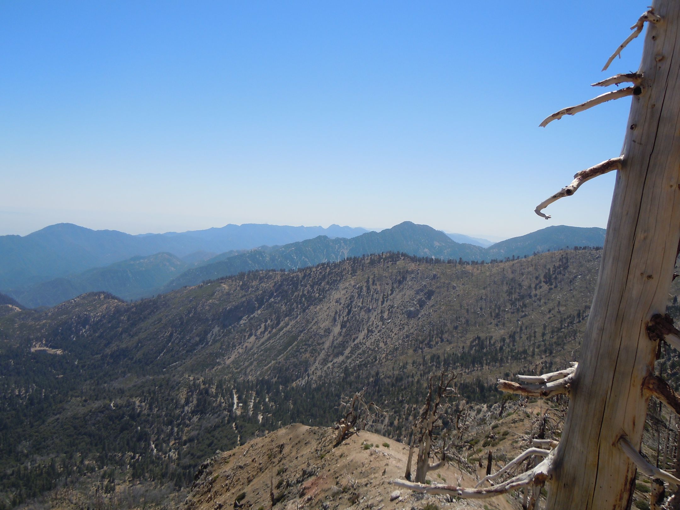
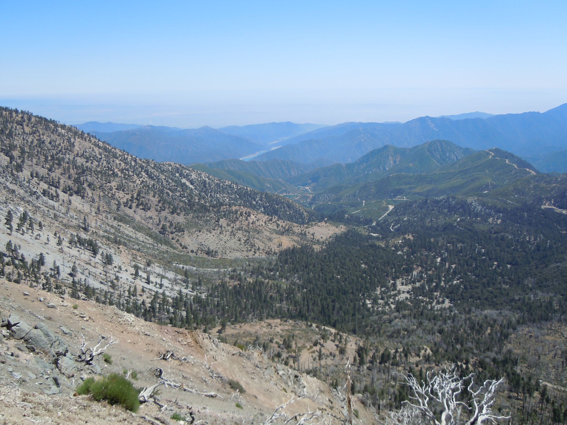
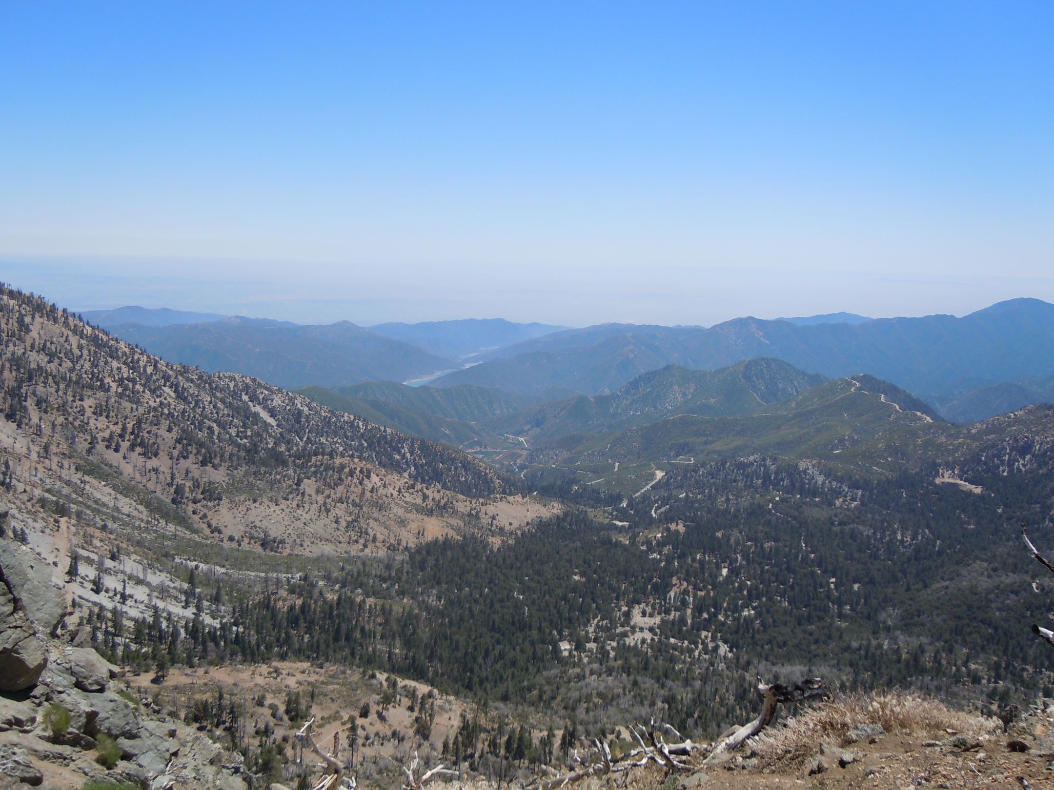
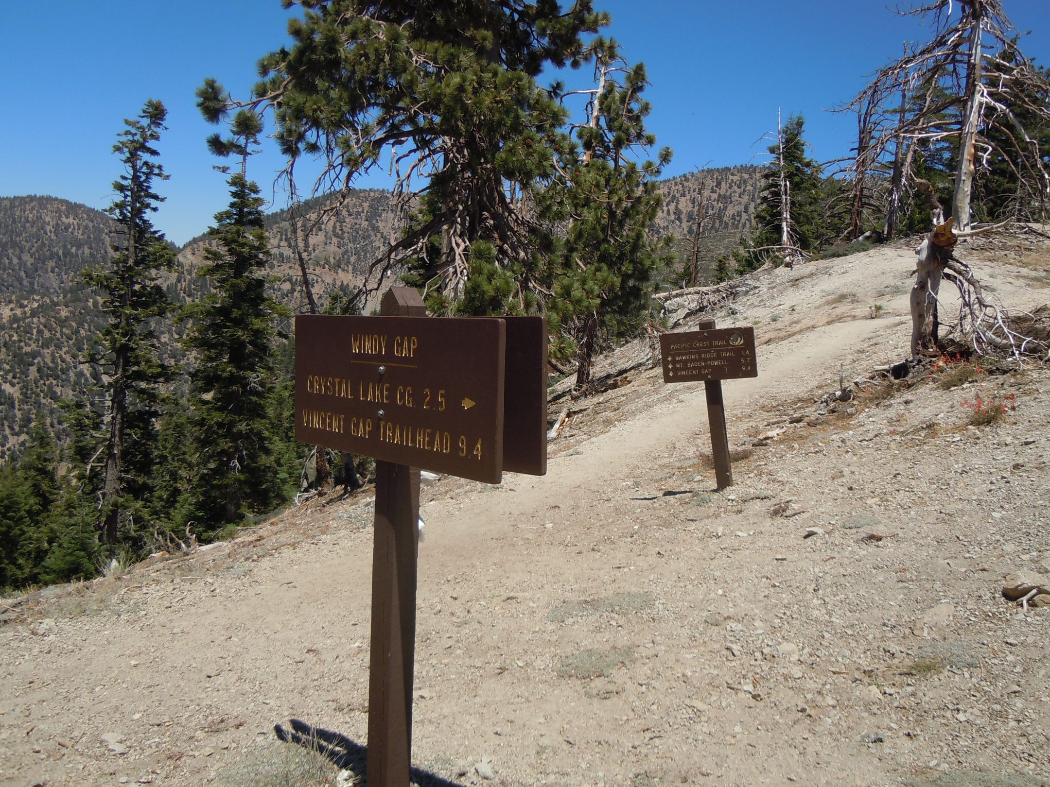
The images above were taken approaching the top of the Windy Gap trail looking back south toward where you came from. In the distance you can see San Gabriel Reservoir and on a clearer day the City of Azusa and even farther to the south. Once you arrive to the apex of the Windy Gap Trail, you’ll also find that this is the location that it intersects the Pacific Crest Trail (PCT). Head “south” (East) on the PCT to access Mt. Baden Powell and Vincent Gap, or head North to get to Little Jimmy Campground and continue on to Islip Saddle, Highway 2 and beyond.
Continuing northward past Windy Gap following along the PCT for another 1/3 mile you’ll arrive at Little Jimmy Trail camp. It is a well developed camp area. with several picnic tables available for use on a first come first serve basis. If you are here in late April – May you will likely find the campground filled with PCT hikers on their endeavor to hike all 2650 miles from Mexico to Canada. When we were there in July 2012 there was a boy scout troop there that had occupied the majority of the lower part of the campground.

There are several amenities at the site beyond the Picnic tables. There is a pit toilet in the campground, but definitely want to check the Forest Service site to determine if it is open or not. At the writing of this post in early 2023 it is not was not open. Campfire rings are allowed, but again you must check with the forest service to ensure that it is legal to use them, as well as being in possession of a campfire permit. Water is available from the generally reliable Little Jimmy Spring which is located just a bit west of the campground but in these days of drought, it’s likely wise to not take any chances, especially late in the season.
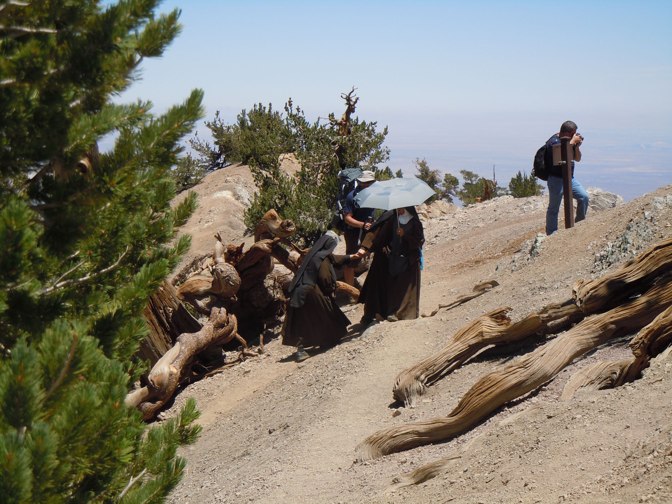
As this hike is in close proximity to millions of people, there’s always the chance to see something or someone that is unique in their own way. On this particular hike, we got to meet up with two fully habit clad Nuns making their way up to Windy gap from the Islip saddle side. Definitely not something that you see every day.
As with all of these largely useless and out of date guides please feel free to contact us if you find something useful, or if you have additional information that we can use to update this post to make it more meaningful, or even just a little bit helpful. Also be sure to check out our latest content from the links below:
- Overnight Backpack to Fern Lake – 100% Cell Service!?Trail Summary and recommendations Getting to the Trailhead Parking and Shuttle Information The trailhead for Fern Lake accessed from the Devils Postpile monument near Mammoth…
- Icehouse Canyon to Chapman Trail LoopTrail Summary Icehouse Canyon trail is a VERY popular and moderately challenging trail located above Mt. Baldy Village. Combining the trip up Icehouse Canyon trail…
- Hiking Mt. Baden Powell via Vincent GapMt. Baden Powell Via Vincent Gap
- Chicken Spring Lake via Cottonwood PassOvernight backpacking trip to Chicken Spring Lake via Cottonwood Pass.
- 5 Mile walk around Bonelli ParkWant to combine a great breakfast with a relatively leisurely 5 mile walk around Bonelli Park? This is the route for you! Trail Description This…

One Comment
Comments are closed.