Cajon Pass – John Brown Toll Road – National Old Trails Road/ Pacific Crest Trail
Exploring Cajon Pass – John Brown Toll Road – National Old Trails Road/ Pacific Crest Trail
Long before the creation of Interstate 15, and even well before the establishment of Route 66 there were a few different routes over the route of what is now known as Cajon Pass. Millions of people each year (ourselves included) have driven by several still visible pieces of these historic routes, and associated places, on their travels up the Interstate 15 without even realizing they are there. While many know about the ever popular Route 66 there were trails and roads that predate the route by nearly a century. Some easily accessible locations to see some of this history is hidden just behind the northbound truck scales just south of the highway 138.
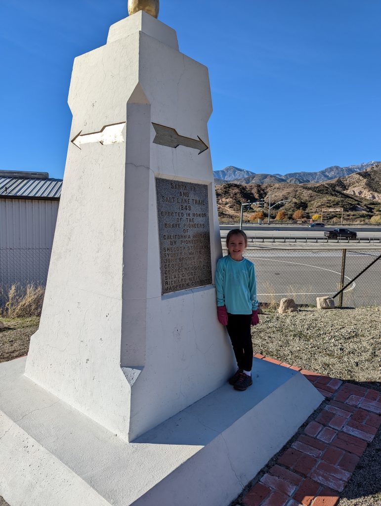
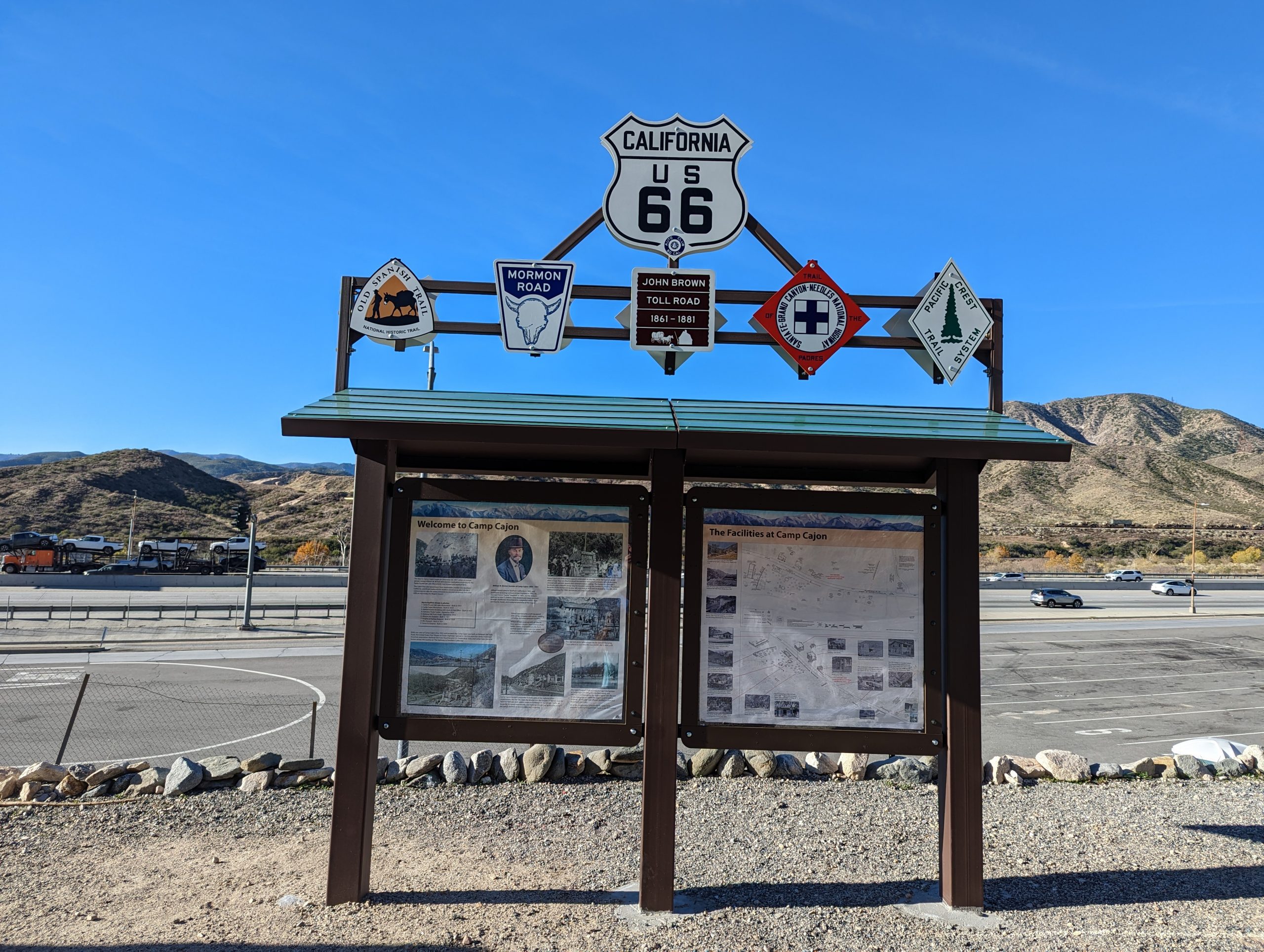
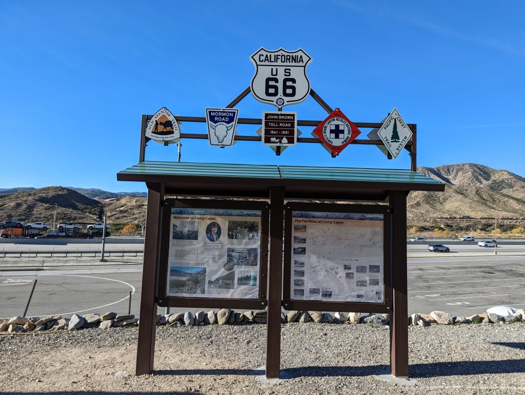
If you’ve traveled the 15 north through the Cajon Pass you may have seen the obelisk for the Santa Fe and Salt Lake Trail. and also the informational kiosk describing Camp Cajon. But if you’ve never exited the interstate to investigate you are missing out on some interesting history. Not readable from the freeway and along the top of the kiosk are several signs representing several other pieces of history in this location. Two of them are closely related and with a very short hike some evidence of a piece of their history can still be seen today.

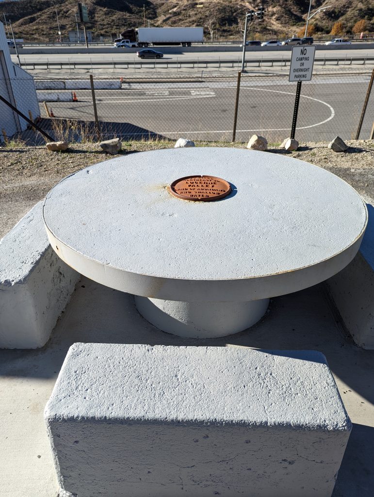
The subject of the main marquee details the history of Camp Cajon. Camp Cajon existed as a welcome station in the early 1900’s for visitors entering the San Bernardino area as they traveled down Route 66. There were many picnic areas with Concrete benches sponsored by local businesses. Unfortunately a flash flood destroyed most of the area in 1930, then the realignment of Route 66 sealed the rest of its fate. What remained of the picnic tables were relocated to parks in the area, one of them with the original sponsor plate was returned to the monument area.
Those of us that enjoy hiking/ backpacking are likely well aware of the Pacific Crest Trail (PCT) that extends between Mexico and Canada, and you may have noticed at the top of the Camp Cajon sign the emblem for the PCT there. That’s because just to the south of the monuments the PCT comes down through Crowder canyon, crosses under Intestate 15 and then ascends back up into the mountains.
Exploring Crowder Canyon and National Old Trails Road from the Pacific Crest Trail
To explore the sights in the next section we hike up a short distance on the Pacific Crest trail. Crossing the road to the East from the location of the monuments lies the access point for the Pacific Crest Trail. Climb the short access trail and and continue to head east, which is technically the southerly direction on the trail. While hiking on the modern day Pacific Crest Trail, you are now also walking on what was a significant road at one time.
The road’s history starts back in 1847-1848. This is obviously long before I-15 and even before Historic Route 66 ran through their respective locations in this area. At that time Jefferson Hunt and his Mormon exploration party (genesis of the name of Mormon Rocks) created a route through Coyote Canyon, now known as Crowder Canyon, that allowed travelers and their wagons a viable path into the San Bernardino area. This route was eventually moved in favor of a more gradual slope that made it easier for the wagon trains, but in 1861 shortly after the discovery of gold in Holcomb Valley, John Brown obtained permission to build a toll road over this same route. John Brown’s route lasted as a toll route for about 20 years.
In the early 1900’s the idea for a national ocean to ocean road was devised. It was decided that the route through Cajon pass would use the existing John Brown toll road. Although it was no longer a toll road, it was still in use by many travelers and could be upgraded to serve the new function. The road was paved, and near the mouth of the canyon a bridge was built to cross the ravine. As we were hiking up this canyon, we were in awe how a road ever existed here. The canyon walls are incredibly steep and the canyon itself is very narrow. in many parts of it, it would be very easy to throw a rock from one side of the canyon to the other.
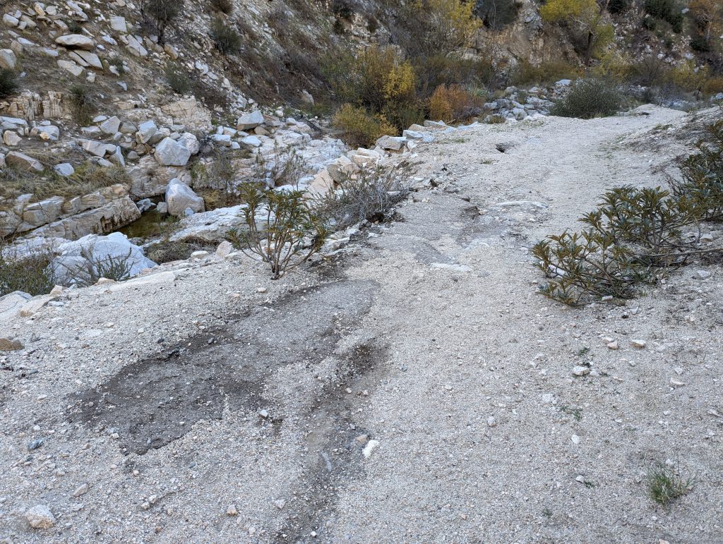
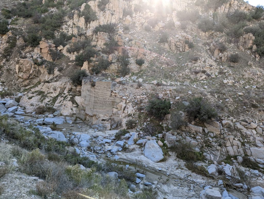
Soon after starting the trail you will come across patches of asphalt in and along the trail. This is a memory of the road that once was. Its interesting that over 100 years later the asphalt still exists. Perhaps even more interesting is the remnants of a bridge to support the roads path down the canyon. on both sides of the canyon you can see the abutments that anchored each side.
If you’re traveling through the Cajon Pass and have an extra 30 minutes, this is a very interesting side trip to see some early California history. Thanks to Sidetrack Adventures for making a video about this as it’s how we found out what we were missing here.

