Section Hiking The John Muir Trail
Table of Contents
About the John Muir Trail
If you’re reading this then you already know this, but it seems to be the required statement on every blog or journal that is in regards to this trail so here it goes…
The John Muir trail is the preeminent long distance west coast trail not labeled with the acronym PCT. It is 211 miles long (not including the 11 miles from the Whitney summit down to the portal) and traverses through three different national Parks. Most people start in Yosemite and complete the journey at the highest point in the continental United States, Mt. Whitney.
Permits and Transportation
Whether section hiking the John Muir trail or doing a thru hike, an important part of the planning process is permits. In recent years getting a permit to start a Southbound hike in Yosemite has become increasingly difficult, especially if you travel with a group of 3 or more people. This is due to the NPS limiting the number of people exiting Yosemite National Park via Donohue pass to 45 total per day. 20 of these permits are for parties starting at Happy Isles, and the remaining 25 are for Lyell Canyon trailhead.
There isn’t a single public transit system to go from Yosemite to Lone Pine/ Whitney portal. However you can combine the ESTA bus system and the YARTS system to get from one end to the other. We utilized both of these services to get from Mammoth to Yosemite Valley and they worked very well for us.
The Long Trail Problem
Since the trail is 211 miles long, not including the mileage from Mt. Whitney to Whitney Portal, for most people it takes a significant amount of time to hike, generally around 3 weeks. As middle class and middle aged adults with pets at home, we couldn’t work it out to take 3 weeks off to thru hike the trail in one shot. With that in mind we still wanted to accomplish our goal but find a way to do it that would maximize our time spent in the mountains and try not to rely on too much external help. That is where the idea of section hiking The John Muir Trail came in.
Our Solution
Section hiking is taking a long distance train and breaking it into chunks done over a period of time. To find out how many chunks we’d need to do in order to complete the trail we had to work out a couple of things first. Primarily daily distance, trailhead locations and travel logistics.
When planning a trip such as this (or these) it’s very important to be aware of your own personal comfort and ability when it comes to daily mileage. Previous trips in the Sierra Mountains told us that our hiking style told us that we were fairly comfortable with doing 8 – 10 mile days. Having prior experience in the area is something that you may not have and this could affect your experience. Nearly all of the John Muir trail is above 8000′ elevation, and a good chunk of your time will be spent above 9000′.
With the daily mileage goal decided upon, we decided that we would take the trail one week at a time. This, combined with our daily hiking goal means that we would have a weekly goal of around 70 miles. This works out pretty nicely (at least on paper) with the trail being 211 miles long to break the trail into 3 70ish mile sections. Now only the difficult question remains…where do those sections start and end?
Section 1 – Happy Isles to Mammoth
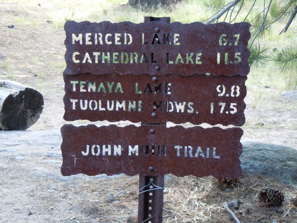
We knew we were going to south on the John Muir Trail so our starting point would be whichever trailhead we were able to get the permit for, but our goal was to start at the traditional starting point of Happy Isles.
From Yosemite looking 70ish miles down the trail puts you in the Mammoth area. This almost works out too nicely from a transportation standpoint as you can basically self support and don’t need additional help. We describe that in more detail with our detailed section 1 trip report. The decision is where in mammoth to exit the trail? The John muir reaches the Mammoth area just around Devil’s postpile which is the “easy” way out. You can continue to hike south to the Mammoth pass or Duck pass intersection and exit that way as well. We intended to go the Duck pass route but lazy us exited just past the bridge at Devils postpile.
This is a very nice introduction to the trail as the elevation stays relatively low until you get to Donohue pass. A nice benefit for this shakedown is that halfway into this section you stop by Tuolumne meadows for a burger and Ice cream!
Section 2 – Mammoth to Taboose Pass
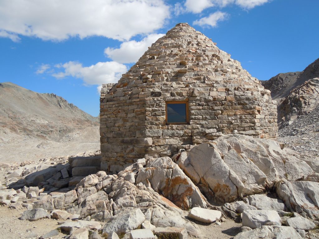
As easy as it was to choose the section from Happy Isles to Mammoth, it was very difficult to figure out where to go between Mammoth and Whitney. There’s really no good options unless you hike all the way to Kearsarge Pass, which stretches the mileage far out past what we were able to do in a week.
The most central location to even out the mileage seemed to be to do the section from Duck Pass in Mammoth to Taboose Pass. This works out to about 90 miles of trail from trailhead to Trailhead meaning we would have to push it a couple of days but that didn’t end up being an issue for us.
On this section we did take advantage of the Muir Trail Ranch resupply services. this significantly lightened our load leaving mammoth since we didn’t have to take the full supply of food.
Logistically the hardest part of this section was getting to and from Taboose Pass trailhead. Unfortunately just the turnoff for it is about 15 miles on US 395. Then there’s another 5.5 miles of dirt road the the trailhead. The dirt road is normally passable by most cars, but if there has been any significant rain it can get some pretty big ruts and exposed rocks requiring a higher clearance vehicle like an SUV. 4 wheel drive isn’t usually required.
It can be difficult to hitchhike from here as there isn’t a lot of traffic to the trailhead, and trying to get someone to stop when they’re doing 70+ on the highway doesn’t usually work too well. That being said, there is a campground a few miles below the trailhead and you might have success talking someone into a ride.
Important note on this route. Taboose Pass is one of the most difficult passes on the Eastern Sierra. If deciding to end your trip at the space with the intention of starting here, it is about 6000′ of elevation gain over 7 miles.
Section 3 – Taboose Pass to Mt. Whitney
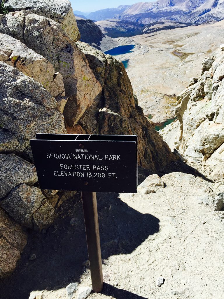
With Section one and two complete, the only thing left is to complete the Journey to Mt. Whitney. The added mileage of Section 2 makes this a relatively short 65 mile section. (note the John Muir Trail technically ends at the summit of Mt. Whitney, so the 11 miles from the summit to the portal aren’t included in the 211 mile trail)
Having already done the High Sierra trail and hiked down into the Rae Lakes basin, we were getting back to familiar territory. The hike up Taboose pass for us was a 2 day affair. Due to its difficult and fairly remote trailhead it’s not well traveled, but it a well established and easy to follow.
We knew that with our full backpacks we wouldn’t be able to do the full 6000′ of elevation in one day, but the smoke we encountered from a fire in Sequoia cut our day even shorter than we had expected. This is an important consideration as it could ad an extra day to your trek.
While Taboose pass is fairly long and steep, after the making the top of the pass the trail then becomes very enjoyable (well except for forester pass of course) and is probably the most scenic section of the entire trail.
Conclusion
If you don’t have the time to do the JMT all at once, it’s definitely possible and perhaps even more enjoyable to break it up into sections. You can avoid weather (thunderstorms suck!), preserve vacation, or even combine your section hike with side trips taking an extra half day to visit Half dome (permit required), Mammoth Hot springs, or any other multitudes of things to do and see in the Sierra mountain range.

