Overnight Backpack to Fern Lake – 100% Cell Service!?
Table of Contents
Trail Summary and recommendations
Getting to the Trailhead
Parking and Shuttle Information
The trailhead for Fern Lake accessed from the Devils Postpile monument near Mammoth Mountain Ski Resort. . Like many of the trails in the Mammoth back country you will likely have to take the Red’s Meadow Shuttle to access it. Information about the Shuttle can be found at the NPS link Here and a Map of the shuttle route can be found HERE. The shuttle can be avoided if arriving before 7am or after 7pm but a fee is still required which is $10/ day or $20 for a 3 day pass as of summer 2025.
If you’re thinking of walking to the trailhead from the overnight parking in Mammoth Mountain it makes the trailhead about 7 miles and 1600′ in elevation loss which translates to a nasty gain on the way back. If taking the shuttle plan to arrive well before your desired departure time, as on weekends during the summer it may take multiple bus arrivals (leaving ever 30 min) before you can board one and begin the trip down the hill.
Overnight Parking for hikers and campers starts about 1/3 of a mile East on Minaret Road by Mammoth Mountain Trolley stop 6. Important note that this is the Mammoth Trolley which is not to be confused with the Red’s Meadow shuttle which picks up directly in front of the Mammoth Adventure Center. Also not to be confused with Red’s Meadow Trolley stop 6 which is mentioned later on.
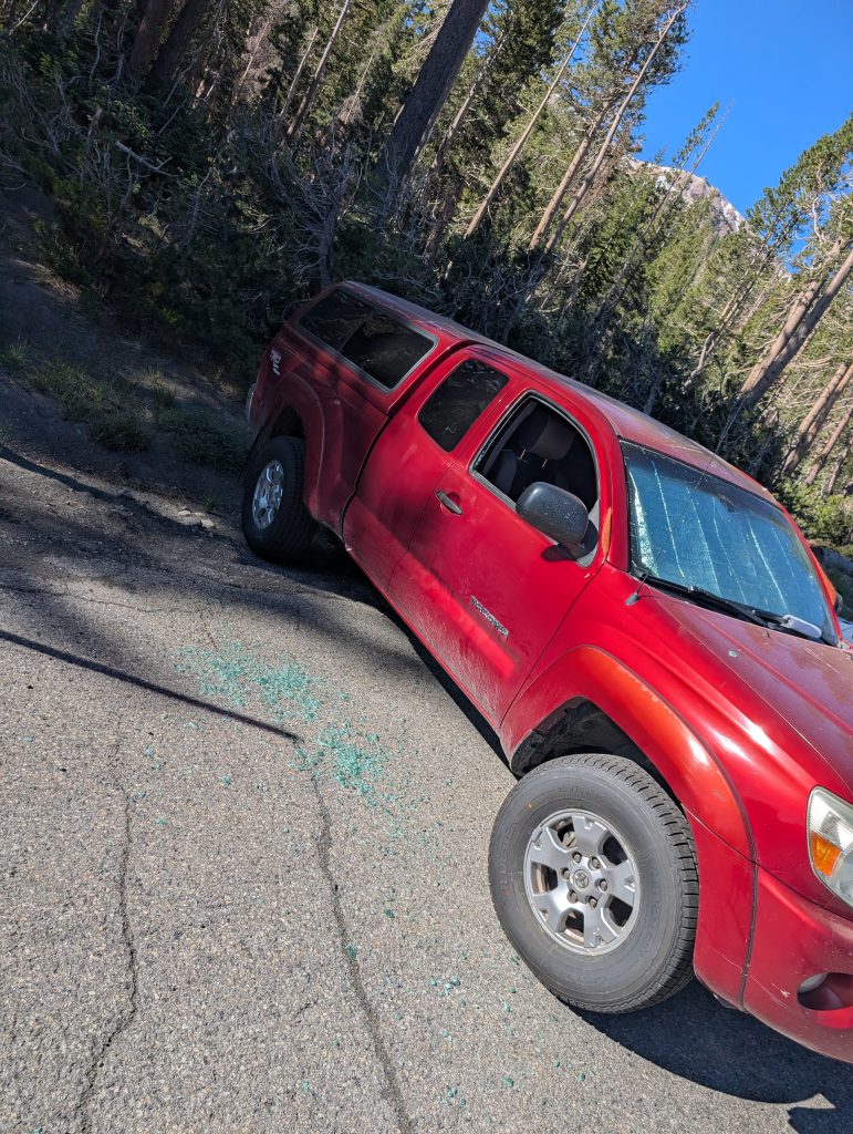
Be sure to fully empty your vehicle of anything that smells as the bears in the area can be quite curious as the owner of the red truck below found out. The owner had hung blankets in the windows to obscure the view, but left an ice chest in the front seat.
Finding The Trailhead and Then the Trail
This was one of the less intuitive trails to find that we’ve been on but becomes a bit clear after you actually sit and digest the map (or just follow the steps below). Our main issue was the names of the trails and the destinations didn’t necessarily line up and that caused confusion.
From the Mammoth Adventure Center getting to the trailhead straightforward. Purchase your tickets in advance or in person for the previously mentioned Red’s Meadow shuttle. You will take this shuttle to the Devil’s Postpile stop. That’s stop #6 on the shuttle route. Unfortunately if you’re on a crowded bus, it’s where 95% of the other people with you are going.
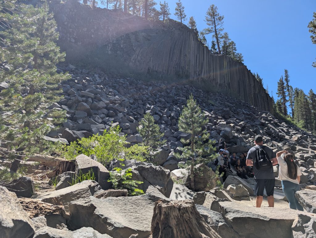
The shuttle will deliver you directly in front of the Ranger station. After de-boarding the bus, follow the main crowd towards Devils Post Pile. The trail to Fern Lake shares the same Devils Postpile Trailhead but turns off about .2 miles before the Postpile itself. For the cost of that additional .4 miles (.2 each way) highly recommend that you visit the postpile if you haven’t seen it before. It’s a bit smaller than you might expect, but is still an interesting piece of geology. you can take the trail to go to the top of it, or just enjoy the view from the bottom.
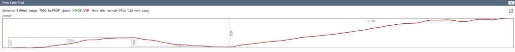
Route and Elevation Map (CalTopo)
Trail Photos and Description
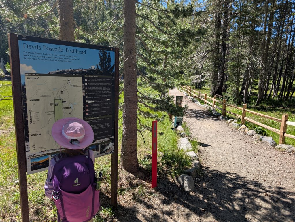
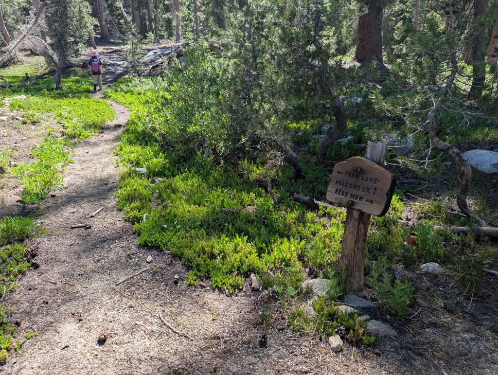
As mentioned, the trail to fern lake starts out at the Devils Postpile Trailhead. There’s a nice sign at the beginning of the trail. It even has a nice marker on it showing that Fern Lake is down the Kings Creek Trail. This should make things easy right?
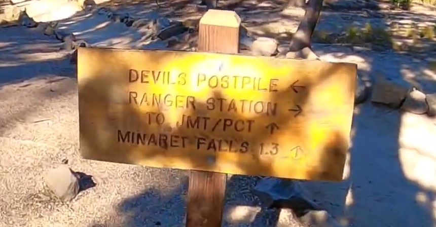
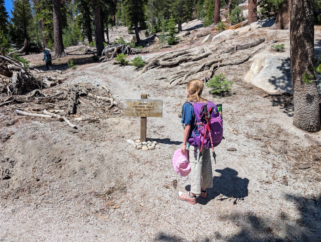
Well as the great Lee Corso would say…not so fast my friend! To get onto the Kings Creek Trail, there’s really no sign specifically saying what it is, you have to follow the sign to the JMT/PCT trails which is indicated by the sign below. No mention of Fern Lake, or Kings Creek.
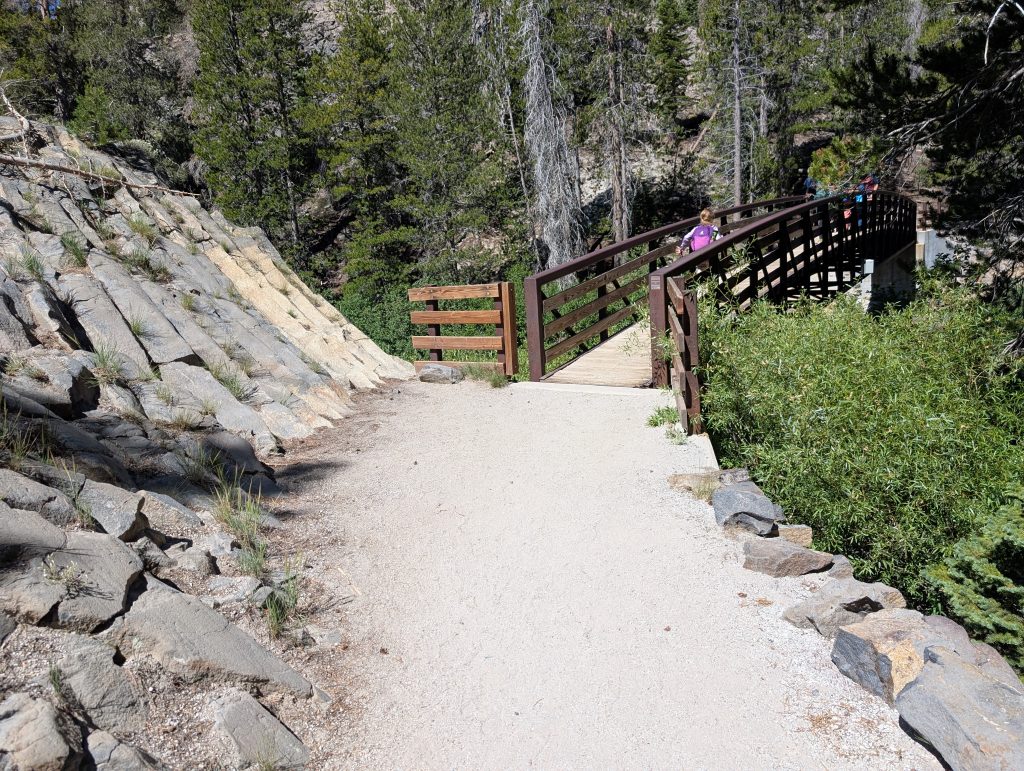
Shortly after leaving the Devil’s Postpile trail you will cross the Middle Fork of the San Joaquin River, be sure to take a few selfies as this may be the last time you feel fresh enough to do so. The elevation gain begins to start just after the end of the bridge.
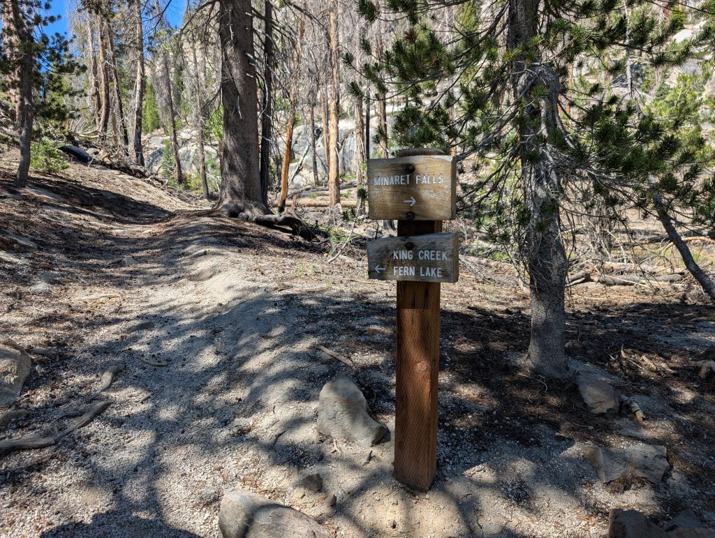
Just past the bridge stay left to enter the Kings Creek Trail that will lead the way up to Fern Lake. You could be tempted to visit Minaret Falls, but that would add several miles to your trip so perhaps save it for the return trip.
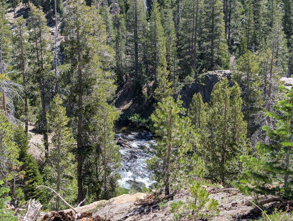
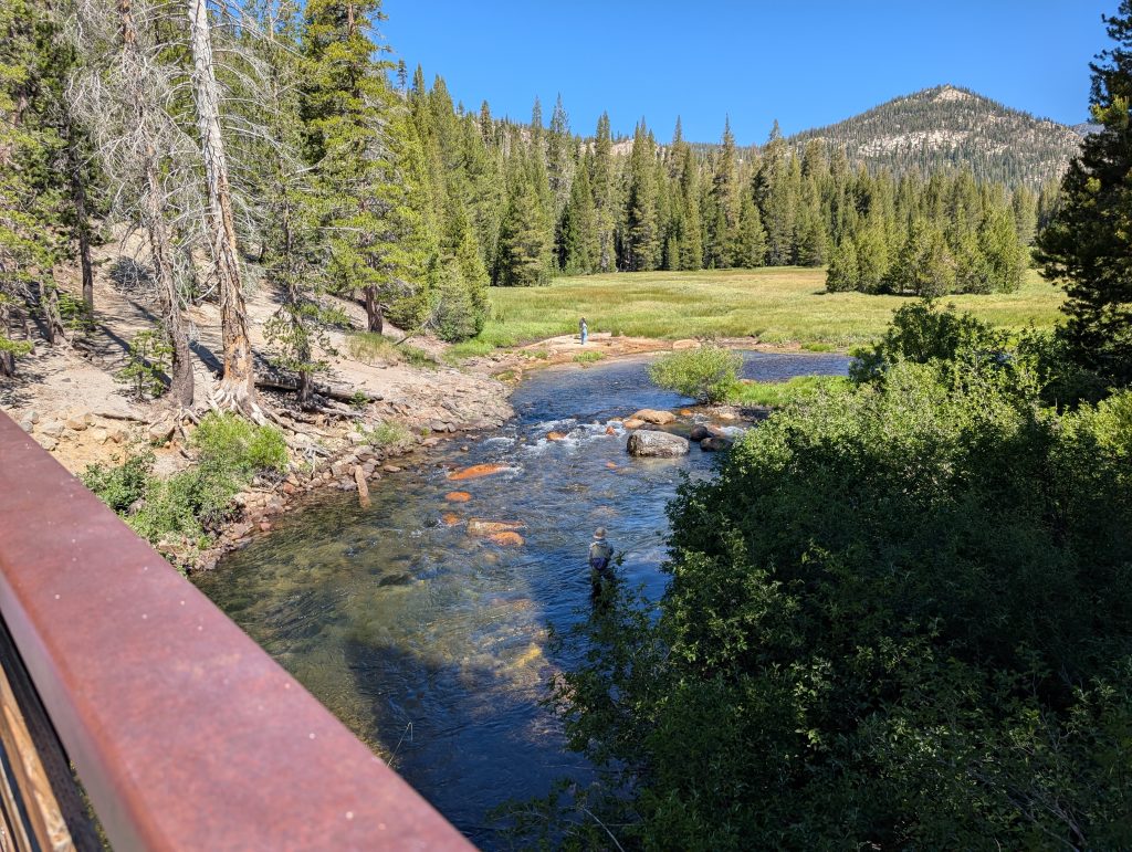
Quickly after leaving the bridge you start gaining elevation. In only a few minutes you have a very nice view of the river that you were on the same level with.
Our Trip was in early July and you can see by the dejected head tilt from the 8 year old that it was already getting hot and miserable and we’d only gone a little over half of a mile from the trailhead! Turns out when you don’t start hiking until 10am it can still get hot at 7,700′ (had to wait for a couple full shuttle buses). Thankfully there was still shade from the trees and many breaks were taken. A little over 1 mile from the trailhead the climbing will turn to descent. Through this section there were a few down trees that obscured the trail but nothing that got us severely off track. Also even if we did get off track, cell service was still readily available to help find the way.
At about 1.9 miles there’s a nice lunch spot with a stream crossing to rehydrate and fill water bottles. This stream is listed as potentially seasonal but it was flowing fairly heavily when we crossed it. It was early July though so by the end of August that could be very different. There’s some large fallen trees that are make good tables and seats. If you’re feeling good and just need water, there’s a much larger stream crossing coming up.
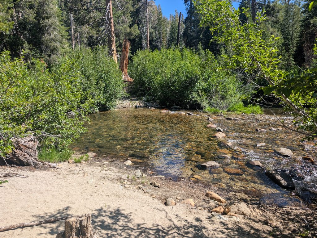
At about the 2.2 mile mark you will mark the bottom of the descent and cross King Creek. In early July this was definitely a feet wet situation. As you can see in the photo above, there are some rocks aligned where you might be able to hop across, but this early in the season there were still just enough gaps where it wasn’t possible to make it all the way across on them.
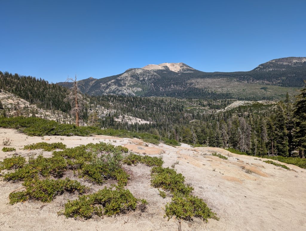
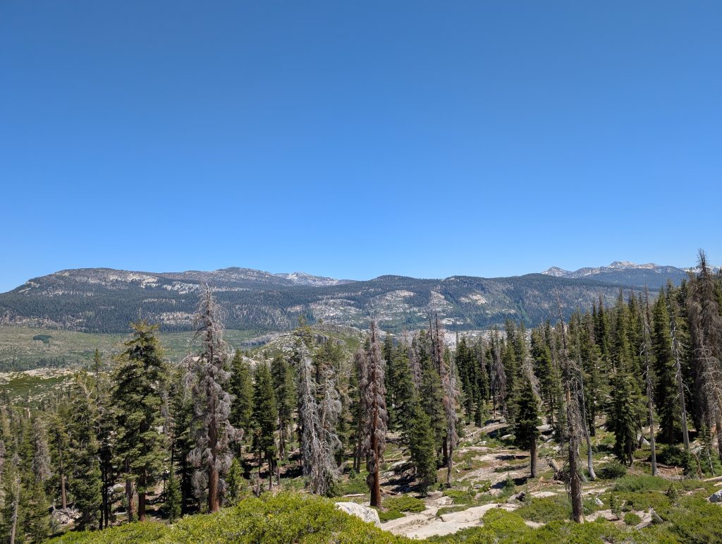
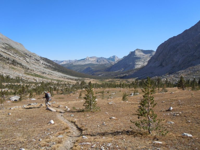
The elevation gain returns as you leave the creek. It starts out nice and shaded, but quickly you get into large granite sheets where the trees become sparse and the sun becomes bright. A consolation is that the views of the San Joaquin river valley are incredible, even if you are walking away from them for the majority of the time. The photos above are about 3.5 miles in from the trailhead.
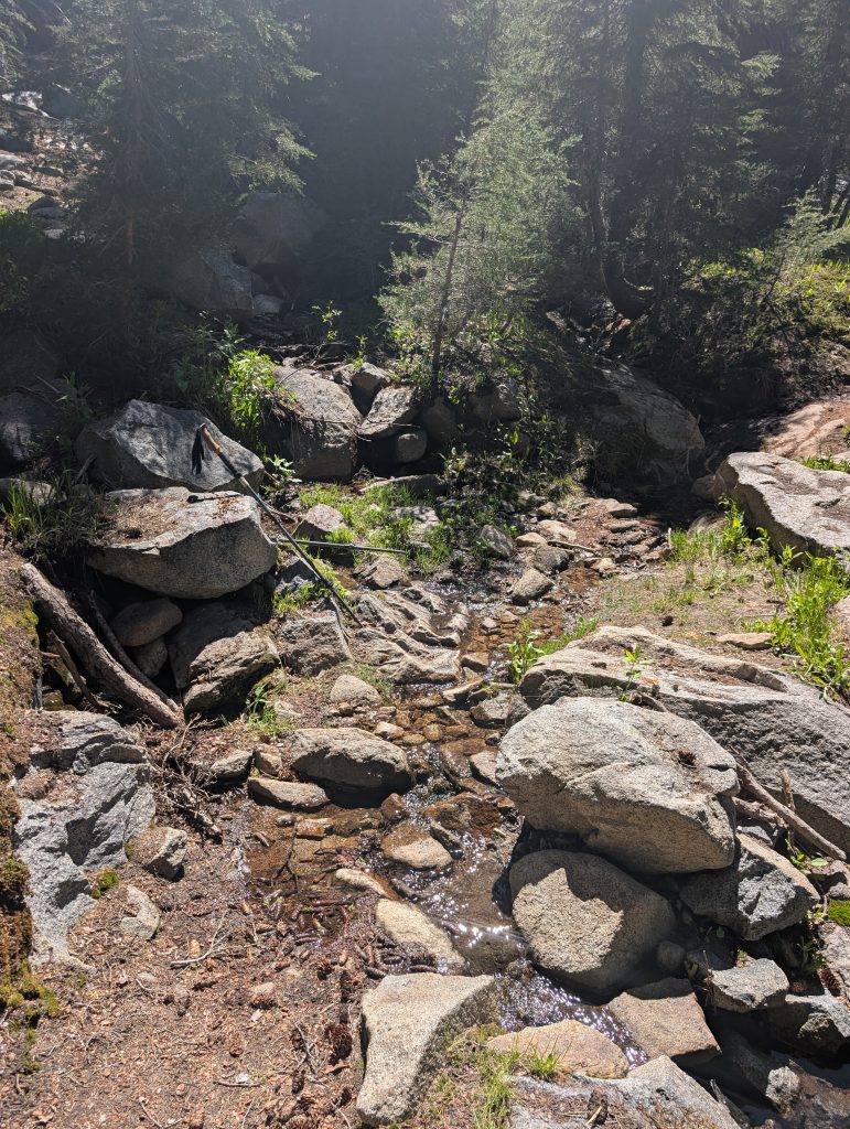
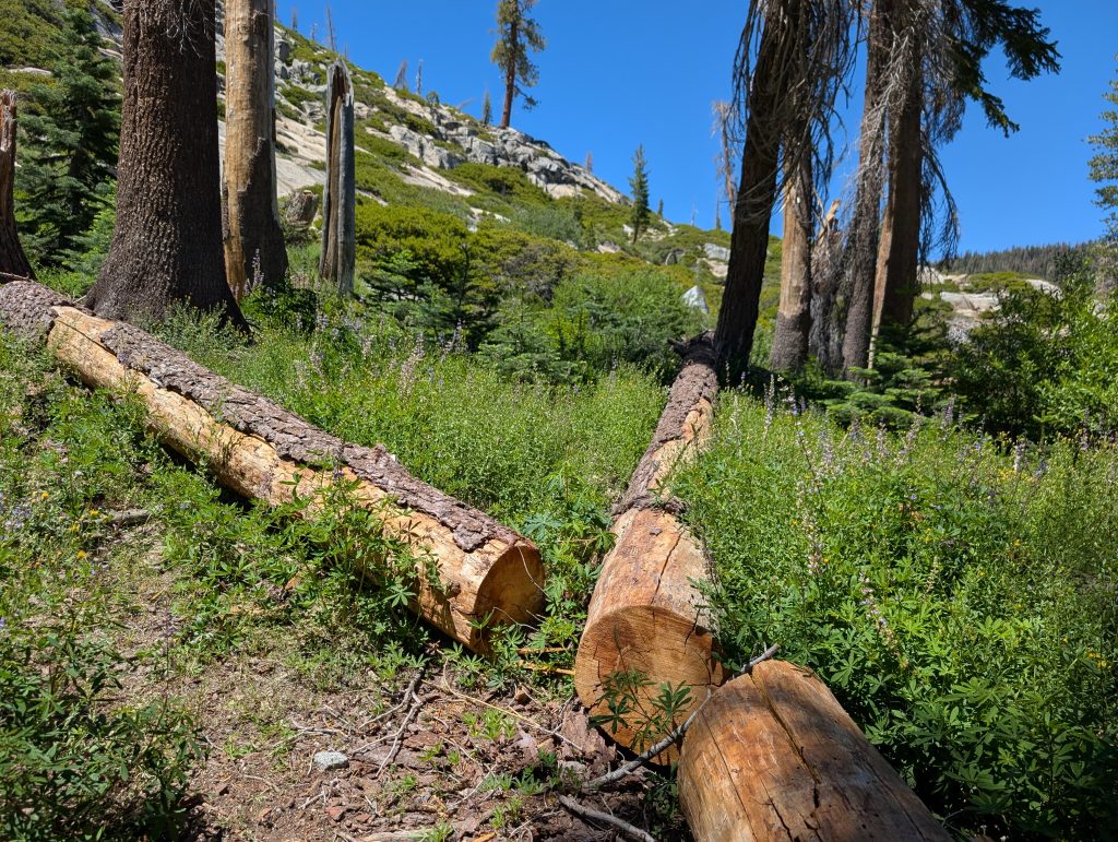
At about the 4.25 mile mark you’ll regain the shade of the trees and have to navigate a few fallen ones. There were 2 times that we had crossed a tree and summarily lost the trail, but it was quickly found again. There was another opportunity for us to wet our hats and fill our bottles of water at a small creek/ spring. This water source I wouldn’t expect to be available late in the summer as it was already barely a trickle when we came across it. In fact looking back at the topo maps it wasn’t even listed and was likely only available to us due to some residual snow that was still hanging around.
This is also where the bugs really started to become a problem. There were patches of snow all around which kept the ground wet, making a beautiful breeding ground for the mosquitos.
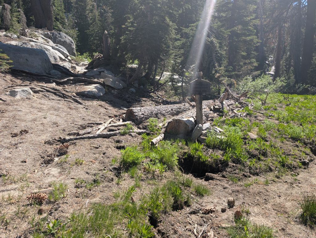
If the water wasn’t flowing and you needed it, not to worry its not long left to go to the lake and the trees will be relatively plentiful until then. you’ll quickly come to the Summit Meadow junction. just carry on straight. This photo illustrates some of the condition of the trail. It was a bit swampy in spots but nothing that couldn’t be easily navigated in trail runners without getting wet.
After about 4.5 miles from the trailhead, you will leave the King Creek trail and begin the final push for Fern Lake. The remaining .3 miles is pretty flat and very enjoyable provided you don’t have the bugs like we did.
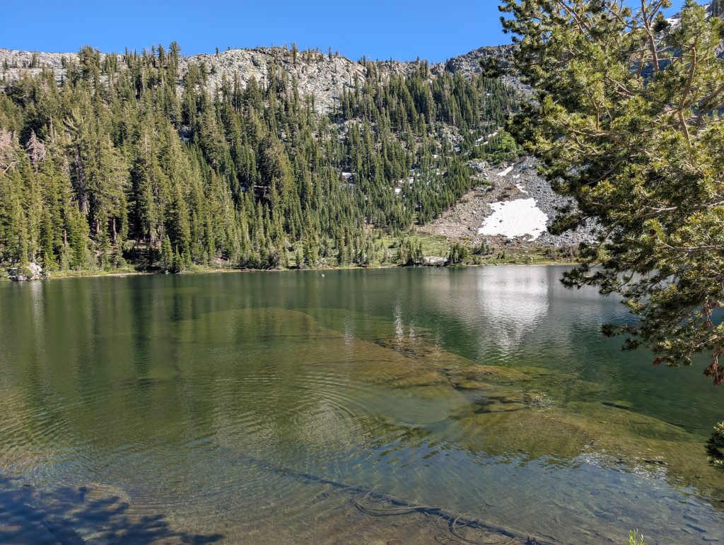
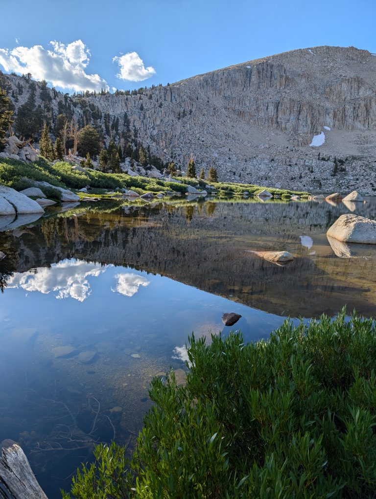
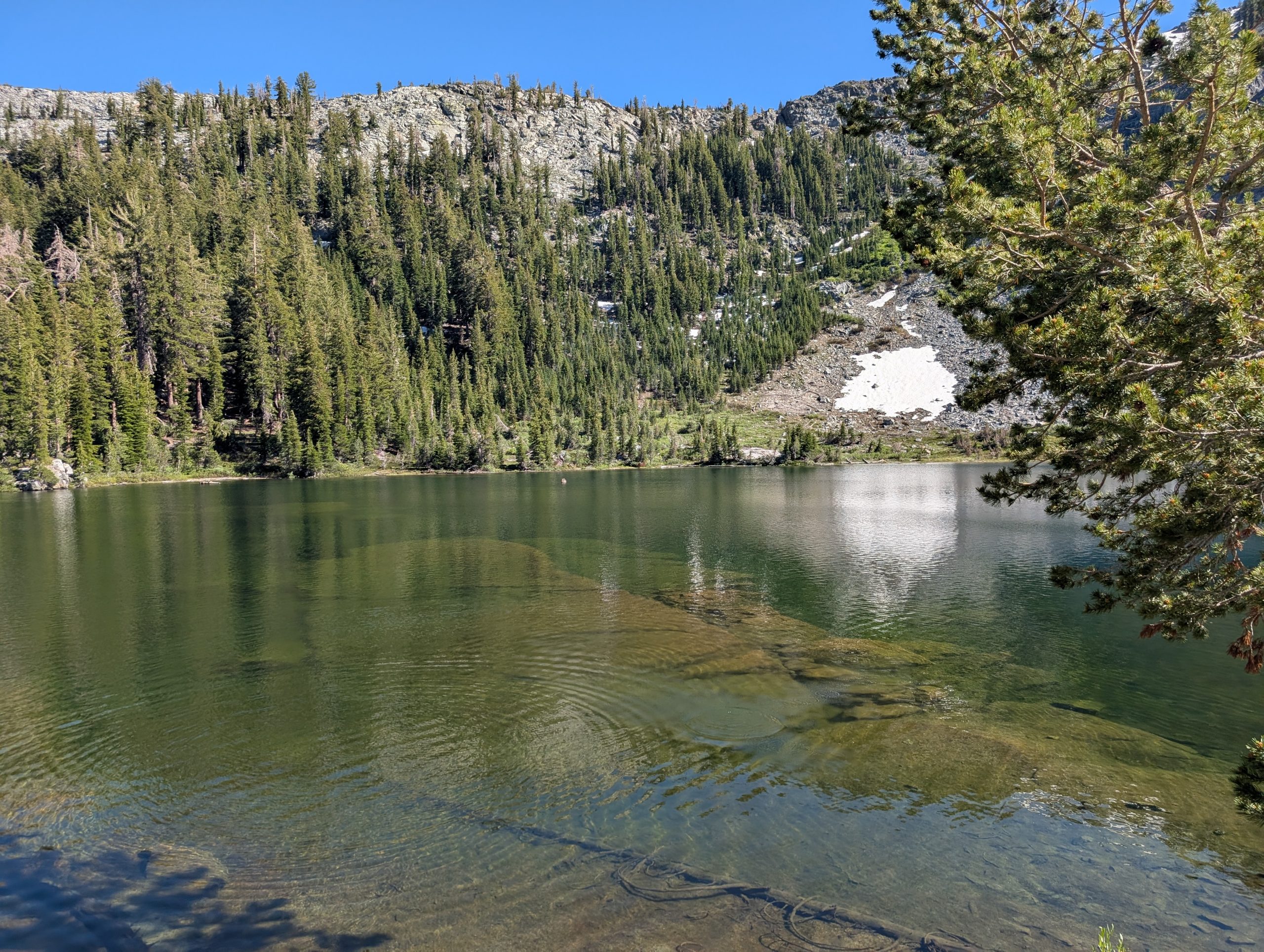
Fern Lake itself is a beautiful body of water. There were plenty of small snow fields surrounding it on the south side. The lake held some fish that we could see but since we didn’t manage to catch any could not confirm the species of trout that they were. Likely rainbows though according to the fish guide.
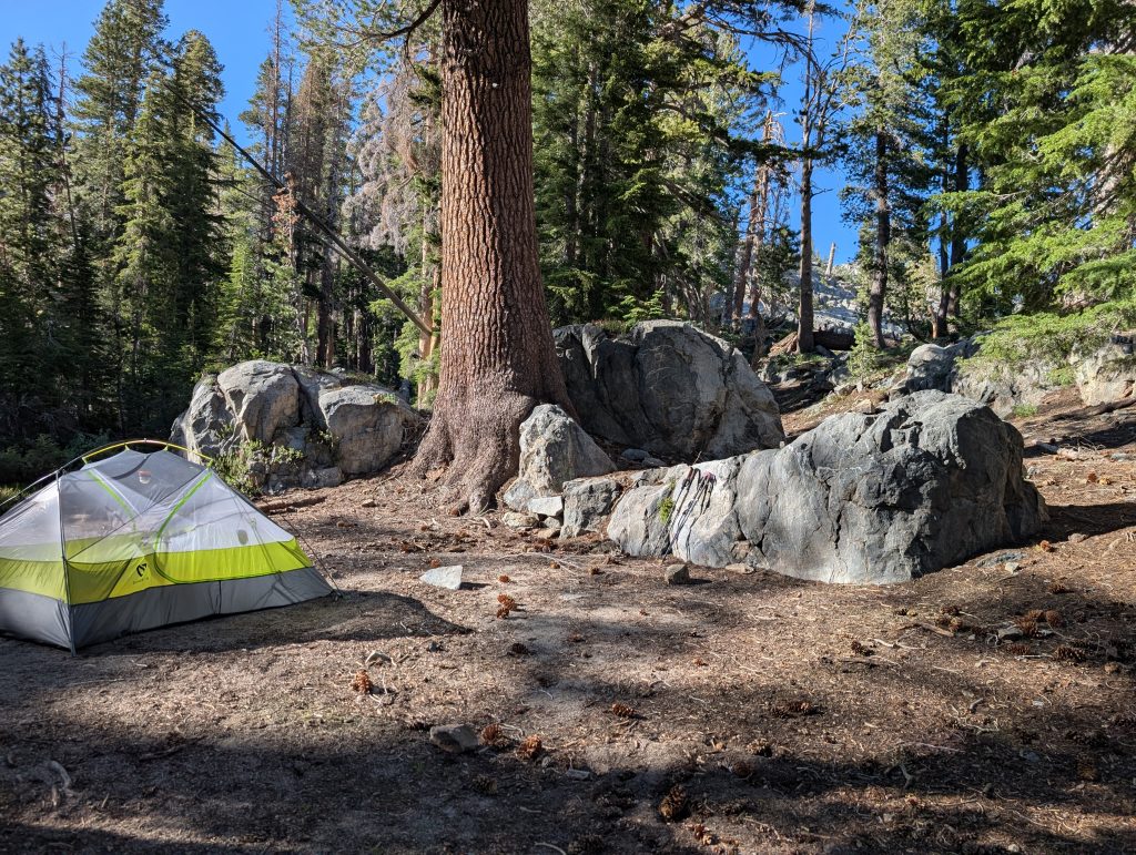
There’s plenty of campsites, with some of them being quite large. We took the first one that we saw on the right side. easily could have put 3 – 4 tents there and still had room to hang out. In hindsight we likely should have gone up the trail a bit more to get more above the water and the bugs, but at the time easier access to fishing was more of a priority.
After camp was set up and we began to relax we noticed the real situation, you can kind of see in the video above the movement that looks like video artifacts, but its actually just the mosquitos executing their attack.
The strangest thing about this hike and campsite is that we had nearly full cellular service the whole way. At one point I woke up around 2am couldn’t go back to sleep and kicked off an episode of Vice Grip Garage just “because I could”. It was an odd situation and not entirely sure how I feel about it. Backpacking trips should at least give the illusion
Conclusion
The hike to Fern lake was fun and a bit challenging due to the sun exposure and heat. The bugs, although plentiful were able to be mitigated with copius amounts of deet, less than stellar solution but sometimes necessary.
Definitely want to return again to complete the loop returning to the Devil’s Postpile trailhead via the Superior Lakes Trail. Can’t pass up the opportunity for a triple trout slam all in one trip (Brook, Rainbow and Golden).